Area Overview for GL2 4UG
Photos of GL2 4UG
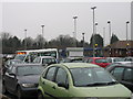
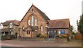
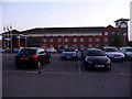

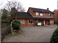
80 photos from this area
Area Information
Key information about the GL2 4UG including its size, population, and administrative classification.
- Area Type
- Postcode
- Area Size
- 1.5 hectares
- Population
- 1149
- Population Density
- 3994 people/km²
House Prices in GL2 4UG
36
Properties
£168,357
Average Sold Price
£40,000
Lowest Price
£290,000
Highest Price
Showing 36 properties
| Address | Type | Beds | Baths | Last Sale Price | Last Sale Date | |
|---|---|---|---|---|---|---|
| 68 Courtfield Road, Quedgeley, Gloucester, GL2 4UG | Semi-detached | 3 | 2 | £290,000 | Nov 2025 | |
| 90 Courtfield Road, Quedgeley, Gloucester, GL2 4UG | Terraced | 3 | 1 | £218,000 | Oct 2024 | |
| 78 Courtfield Road, Quedgeley, Gloucester, GL2 4UG | Bungalow | 2 | 1 | £252,000 | Jun 2024 | |
| 100 Courtfield Road, Quedgeley, Gloucester, GL2 4UG | Bungalow | 2 | 1 | £173,000 | Mar 2023 | |
| 98 Courtfield Road, Quedgeley, Gloucester, GL2 4UG | Bungalow | - | - | £110,000 | Mar 2023 | |
| 56 Courtfield Road, Quedgeley, Gloucester, GL2 4UG | Semi-detached | 3 | 1 | £275,000 | Dec 2022 | |
| 86 Courtfield Road, Quedgeley, Gloucester, GL2 4UG | Terraced | 3 | 1 | £218,000 | Jan 2022 | |
| 72 Courtfield Road, Quedgeley, Gloucester, GL2 4UG | Semi-detached | 3 | 2 | £220,000 | Jul 2021 | |
| 80 Courtfield Road, Quedgeley, Gloucester, GL2 4UG | Bungalow | 2 | 1 | £208,000 | Mar 2021 | |
| 104 Courtfield Road, Quedgeley, Gloucester, GL2 4UG | house | - | - | £168,000 | Feb 2021 |
Page 1 of 4
Energy Efficiency in GL2 4UG
Amenities
Schools
| Rank | School | Type | Entry gender | Ages |
|---|
Explore more schools in this area
Go to Schools tabDemographics
Household Size
Two person
most common
Accommodation Type
Houses
most common
Tenure
82
majority
Ethnic Group
White
most common
Religion
N/A
most common
Household Composition
N/A
most common
Age
47
median
Adults (30-64 years)
most common
Household Deprivation
N/A
with no deprivation
NS-SEC
28
in Lower managerial occupations
Explore more demographic insights in this area
Go to Demographics tabPlanning
Planning Constraints
- Flood RiskPremium
- Ramsar Wetland SitesPremium
- Area of Outstanding Natural BeautyPremium
- Protected Nature ReservePremium
- Protected WoodlandPremium