Area Overview for GL2 4RP
Photos of GL2 4RP
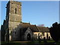
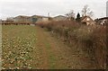
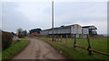
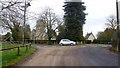
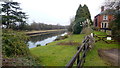
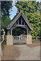
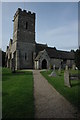
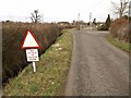
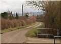

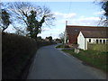
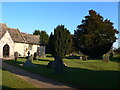
23 photos from this area
Area Information
Key information about the GL2 4RP including its size, population, and administrative classification.
- Area Type
- Postcode
- Area Size
- 32.3 hectares
- Population
- 1823
- Population Density
- 82 people/km²
House Prices in GL2 4RP
20
Properties
£435,244
Average Sold Price
£185,000
Lowest Price
£708,000
Highest Price
Showing 20 properties
| Address | Type | Beds | Baths | Last Sale Price | Last Sale Date | |
|---|---|---|---|---|---|---|
| Fieldgate, Church Lane, Hardwicke, Gloucester, GL2 4RP | Detached | 5 | 4 | £708,000 | May 2025 | |
| Kurna, Church Lane, Hardwicke, Gloucester, GL2 4RP | Bungalow | 4 | 1 | £370,000 | May 2018 | |
| Church House Barn, Church Lane, Hardwicke, Gloucester, GL2 4RP | Detached | 4 | 3 | £599,950 | Feb 2017 | |
| Elysian Fields, Church Lane, Hardwicke, Gloucester, GL2 4RP | Detached | - | - | £530,000 | Feb 2014 | |
| The Old Thatch, Church Lane, Hardwicke, Gloucester, GL2 4RP | Detached | 3 | 2 | £350,000 | Oct 2010 | |
| Elmlea, Church Lane, Hardwicke, Gloucester, GL2 4RP | Detached | - | - | £494,000 | Nov 2007 | |
| Orchard House, Church Lane, Hardwicke, Gloucester, GL2 4RP | Detached | - | - | £245,000 | Jul 2002 | |
| The Old Barn, Church Lane, Hardwicke, Gloucester, GL2 4RP | Detached | - | - | £185,000 | Jun 1998 | |
| Church House, Stank Lane, Hardwicke, Gloucester, GL2 4RP | house | 4 | 2 | - | - | |
| Church House Farm, Church Lane, Hardwicke, Gloucester, GL2 4RP | Detached | 4 | - | - | - |
Page 1 of 2
Energy Efficiency in GL2 4RP
Amenities
Schools
| Rank | School | Type | Entry gender | Ages |
|---|
Explore more schools in this area
Go to Schools tabDemographics
Household Size
Family (3-5 people)
most common
Accommodation Type
Houses
most common
Tenure
81
majority
Ethnic Group
White
most common
Religion
N/A
most common
Household Composition
N/A
most common
Age
47
median
Adults (30-64 years)
most common
Household Deprivation
N/A
with no deprivation
NS-SEC
40
in Lower managerial occupations
Explore more demographic insights in this area
Go to Demographics tabPlanning
Planning Constraints
- Flood RiskPremium
- Ramsar Wetland SitesPremium
- Area of Outstanding Natural BeautyPremium
- Protected Nature ReservePremium
- Protected WoodlandPremium