Area Overview for GL2 4DY
Photos of GL2 4DY


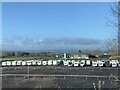

22 photos from this area
Area Information
Key information about the GL2 4DY including its size, population, and administrative classification.
- Area Type
- Postcode
- Area Size
- 4.7 hectares
- Population
- 1961
- Population Density
- 869 people/km²
House Prices in GL2 4DY
45
Properties
£315,952
Average Sold Price
£202,995
Lowest Price
£470,000
Highest Price
Showing 45 properties
| Address | Type | Beds | Baths | Last Sale Price | Last Sale Date | |
|---|---|---|---|---|---|---|
| 38 Knotgrass Way, Hardwicke, Gloucester, GL2 4DY | Detached | 3 | 2 | £280,000 | Sep 2025 | |
| 24 Knotgrass Way, Hardwicke, Gloucester, GL2 4DY | Detached | 4 | 3 | £470,000 | Nov 2024 | |
| 13 Knotgrass Way, Hardwicke, Gloucester, GL2 4DY | Detached | 4 | 2 | £382,500 | Aug 2024 | |
| 32 Knotgrass Way, Hardwicke, Gloucester, GL2 4DY | Detached | 4 | 2 | £382,500 | Jun 2024 | |
| 44 Knotgrass Way, Hardwicke, Gloucester, GL2 4DY | Semi-detached | 3 | 2 | £280,000 | Aug 2023 | |
| 40 Knotgrass Way, Hardwicke, Gloucester, GL2 4DY | Semi-detached | 3 | 2 | £285,000 | Jul 2022 | |
| 46 Knotgrass Way, Hardwicke, Gloucester, GL2 4DY | house | - | - | £368,995 | Feb 2021 | |
| 12 Knotgrass Way, Hardwicke, Gloucester, GL2 4DY | Terraced | 3 | 3 | £239,995 | Sep 2020 | |
| 18 Knotgrass Way, Hardwicke, Gloucester, GL2 4DY | house | - | - | £245,995 | May 2020 | |
| 21 Knotgrass Way, Hardwicke, Gloucester, GL2 4DY | house | - | - | £323,000 | Apr 2020 |
Page 1 of 5
Energy Efficiency in GL2 4DY
Amenities
Schools
| Rank | School | Type | Entry gender | Ages |
|---|
Explore more schools in this area
Go to Schools tabDemographics
Household Size
Family (3-5 people)
most common
Accommodation Type
Houses
most common
Tenure
80
majority
Ethnic Group
White
most common
Religion
N/A
most common
Household Composition
N/A
most common
Age
47
median
Adults (30-64 years)
most common
Household Deprivation
N/A
with no deprivation
NS-SEC
44
in Lower managerial occupations
Explore more demographic insights in this area
Go to Demographics tabPlanning
Planning Constraints
- Flood RiskPremium
- Ramsar Wetland SitesPremium
- Area of Outstanding Natural BeautyPremium
- Protected Nature ReservePremium
- Protected WoodlandPremium