Area Overview for GL2 2RG
Photos of GL2 2RG
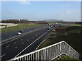

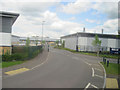

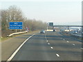
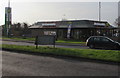


67 photos from this area
Area Information
Key information about the GL2 2RG including its size, population, and administrative classification.
- Area Type
- Postcode
- Area Size
- 77.7 hectares
- Population
- 1961
- Population Density
- 869 people/km²
House Prices in GL2 2RG
18
Properties
£314,636
Average Sold Price
£180,000
Lowest Price
£600,000
Highest Price
Showing 18 properties
| Address | Type | Beds | Baths | Last Sale Price | Last Sale Date | |
|---|---|---|---|---|---|---|
| The Former Telephone Exchange, Bath Road, Hardwicke, Gloucester, GL2 2RG | Bungalow | 1 | 1 | £180,000 | Apr 2025 | |
| Crossways, Bath Road, Hardwicke, Gloucester, GL2 2RG | Semi-detached | 3 | 1 | £315,000 | May 2022 | |
| Cotswold View, Bath Road, Hardwicke, Gloucester, GL2 2RG | house | - | - | £310,000 | Nov 2021 | |
| Trevose, Bath Road, Hardwicke, Gloucester, GL2 2RG | house | - | - | £310,000 | Oct 2021 | |
| Springfield, Bath Road, Hardwicke, Gloucester, GL2 2RG | Detached | 4 | 2 | £412,000 | Sep 2021 | |
| Windyridge, Bath Road, Hardwicke, Gloucester, GL2 2RG | Detached | 3 | - | £311,000 | Aug 2019 | |
| Flat, Cross Keys Inn, Bristol Road, Hardwicke, Gloucester, GL2 2RG | Flat | - | - | £600,000 | Jun 2019 | |
| Newlands, Bath Road, Hardwicke, Gloucester, GL2 2RG | Semi-detached | 3 | 1 | £260,000 | Dec 2018 | |
| Tarras, Bath Road, Hardwicke, Gloucester, GL2 2RG | Detached | 4 | 1 | £305,000 | Mar 2018 | |
| Lynbury, Bath Road, Hardwicke, Gloucester, GL2 2RG | Detached | 3 | - | £245,000 | Oct 2014 |
Page 1 of 2
Energy Efficiency in GL2 2RG
Amenities
Schools
| Rank | School | Type | Entry gender | Ages |
|---|
Explore more schools in this area
Go to Schools tabDemographics
Household Size
Family (3-5 people)
most common
Accommodation Type
Houses
most common
Tenure
80
majority
Ethnic Group
White
most common
Religion
N/A
most common
Household Composition
N/A
most common
Age
47
median
Adults (30-64 years)
most common
Household Deprivation
N/A
with no deprivation
NS-SEC
44
in Lower managerial occupations
Explore more demographic insights in this area
Go to Demographics tabPlanning
Planning Constraints
- Flood RiskPremium
- Ramsar Wetland SitesPremium
- Area of Outstanding Natural BeautyPremium
- Protected Nature ReservePremium
- Protected WoodlandPremium