Area Overview for GL2 2BS
Photos of GL2 2BS
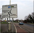
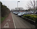
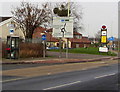
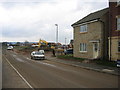
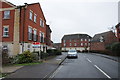
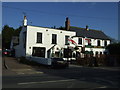
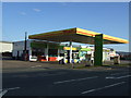
22 photos from this area
Area Information
Key information about the GL2 2BS including its size, population, and administrative classification.
- Area Type
- Postcode
- Area Size
- 1.8 hectares
- Population
- 1541
- Population Density
- 6510 people/km²
House Prices in GL2 2BS
70
Properties
£195,425
Average Sold Price
£50,000
Lowest Price
£405,000
Highest Price
Showing 70 properties
| Address | Type | Beds | Baths | Last Sale Price | Last Sale Date | |
|---|---|---|---|---|---|---|
| 83 Valley Gardens Kingsway, Quedgeley, Gloucester, GL2 2BS | Flat | - | - | £72,500 | Sep 2025 | |
| 79 Valley Gardens Kingsway, Quedgeley, Gloucester, GL2 2BS | Flat | 2 | 1 | £70,000 | May 2025 | |
| 17 Valley Gardens Kingsway, Quedgeley, Gloucester, GL2 2BS | Terraced | 2 | 1 | £105,000 | Mar 2025 | |
| 85 Valley Gardens Kingsway, Quedgeley, Gloucester, GL2 2BS | Flat | 2 | 1 | £123,000 | Feb 2025 | |
| 73 Valley Gardens Kingsway, Quedgeley, Gloucester, GL2 2BS | Semi-detached | 4 | - | £282,000 | Jul 2023 | |
| 31 Valley Gardens Kingsway, Quedgeley, Gloucester, GL2 2BS | Semi-detached | 5 | 2 | £325,000 | Jan 2023 | |
| 57 Valley Gardens Kingsway, Quedgeley, Gloucester, GL2 2BS | Semi-detached | 4 | 3 | £305,000 | Aug 2022 | |
| 23 Valley Gardens Kingsway, Quedgeley, Gloucester, GL2 2BS | house | - | - | £405,000 | Dec 2021 | |
| 27 Valley Gardens Kingsway, Quedgeley, Gloucester, GL2 2BS | house | 3 | - | £222,000 | Dec 2021 | |
| 71 Valley Gardens Kingsway, Quedgeley, Gloucester, GL2 2BS | house | - | - | £222,500 | Jan 2021 |
Page 1 of 7
Energy Efficiency in GL2 2BS
Amenities
Schools
| Rank | School | Type | Entry gender | Ages |
|---|
Explore more schools in this area
Go to Schools tabDemographics
Household Size
Family (3-5 people)
most common
Accommodation Type
Houses
most common
Tenure
67
majority
Ethnic Group
White
most common
Religion
N/A
most common
Household Composition
N/A
most common
Age
47
median
Adults (30-64 years)
most common
Household Deprivation
N/A
with no deprivation
NS-SEC
36
in Lower managerial occupations
Explore more demographic insights in this area
Go to Demographics tabPlanning
Planning Constraints
- Flood RiskPremium
- Ramsar Wetland SitesPremium
- Area of Outstanding Natural BeautyPremium
- Protected Nature ReservePremium
- Protected WoodlandPremium