Area Overview for GL2 0LF
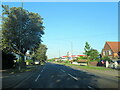
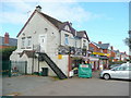
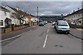
Photos of GL2 0LF


Area Information
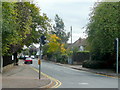
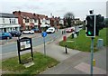
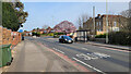
Living in GL2 0LF offers a compact, densely populated residential experience within a small cluster of homes. The area covers just 3.9 hectares, yet it accommodates 1,542 residents, resulting in a population density of 39,456 people per square kilometre. This high density suggests a tightly knit community, though the area’s small size means it is likely a quiet, low-traffic neighbourhood. The proximity to Gloucester Railway Station and Cheltenham Spa Railway Station provides easy access to regional travel, while nearby airports and retail hubs like Tesco Longlevens and Sainsburys Barnwood ensure daily convenience. With a median age of 47 and a majority of residents aged 30–64, GL2 0LF is a mature community, likely centred around family homes and long-term residents. The area’s compact nature means amenities are within practical reach, though its size may limit the diversity of local facilities. For buyers seeking a small, established neighbourhood with straightforward access to transport and retail, GL2 0LF could be a pragmatic choice.
- Area Type
- Postcode
- Area Size
- 3.9 hectares
- Population
- 1542
- Population Density
- 3749 people/km²
The property market in GL2 0LF is characterised by a high rate of home ownership (67%), with houses being the primary accommodation type. This suggests a market skewed towards owner-occupied properties rather than rental units, which may appeal to buyers seeking long-term stability. The small area size and high population density indicate a limited number of available properties, potentially making the market competitive for those looking to purchase within the immediate vicinity. The predominance of houses implies a focus on family homes or single-unit properties, which may align with the area’s demographic of middle-aged residents. Buyers should consider the compact nature of the area, as expansion or development options may be constrained by its small footprint. The market’s character is likely defined by established homes rather than new builds, offering a blend of traditional housing stock.
House Prices in GL2 0LF
Showing 1 properties
| Address | Type | Beds | Baths | Last Sale Price | Last Sale Date | |
|---|---|---|---|---|---|---|
| Sir Thomas Rich's Bowls Club, 38 Oakleaze, Gloucester, GL2 0LF | Leisure | - | - | - | - |
Energy Efficiency in GL2 0LF
Residents of GL2 0LF have access to a range of nearby amenities, including retail stores such as Tesco Longlevens, Co-op Longlevens, and Sainsburys Barnwood. These shops provide everyday convenience, from groceries to household essentials. The area’s proximity to Gloucester and Cheltenham railway stations offers easy access to broader regional services, while the nearby airports cater to those requiring air travel. Though the data does not specify parks or leisure facilities, the presence of multiple retail and transport options suggests a practical, service-oriented lifestyle. The compact nature of the area means amenities are within walking or short driving distance, though the lack of detailed information on green spaces or recreational facilities leaves gaps in understanding the full character of daily life here.
Amenities
Schools
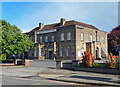
The nearest school to GL2 0LF is Elmbridge Primary School, which serves the local community with a primary education offering. Its Ofsted rating of ‘good’ indicates a satisfactory standard of teaching and facilities, though no secondary schools are listed in the data. The absence of secondary education options within the area may require families to look further afield for high school placements. For primary education, Elmbridge Primary School provides a local solution, reducing the need for long commutes. The school’s presence suggests a focus on family-friendly infrastructure, though the lack of additional educational institutions highlights a potential limitation for households with older children. Parents should consider the proximity of secondary schools when evaluating the area’s suitability for their needs.
| Rank | School | Type | Entry gender | Ages |
|---|
Explore more schools in this area
Go to Schools tabDemographics
The community in GL2 0LF is predominantly composed of adults aged 30–64, with a median age of 47. This suggests a mature, stable population, likely with long-term residency patterns. Home ownership is high at 67%, indicating a strong presence of owner-occupied properties rather than rental units. The accommodation type is primarily houses, which aligns with the area’s small, residential character. The predominant ethnic group is White, reflecting a homogenous demographic profile. While specific data on deprivation or diversity is not provided, the high home ownership rate and age distribution imply a relatively stable economic environment. The absence of detailed diversity metrics means the community’s social composition remains largely unexplored in the data, though the figures suggest a focus on established, middle-aged households.
Household Size
Accommodation Type
Tenure
Ethnic Group
Religion
Household Composition
Age
Household Deprivation
NS-SEC
Explore more demographic insights in this area
Go to Demographics tabPlanning
Planning Constraints
- Flood RiskPremium
- Ramsar Wetland SitesPremium
- Area of Outstanding Natural BeautyPremium
- Protected Nature ReservePremium
- Protected WoodlandPremium