Area Overview for GL2 0JG
Photos of GL2 0JG

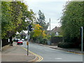
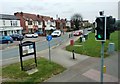
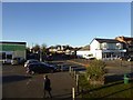
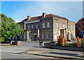
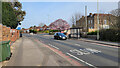
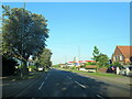
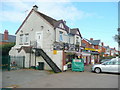
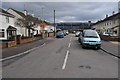


15 photos from this area
Area Information
Key information about the GL2 0JG including its size, population, and administrative classification.
- Area Type
- Postcode
- Area Size
- 2.6 hectares
- Population
- 1520
- Population Density
- 3990 people/km²
House Prices in GL2 0JG
45
Properties
£326,577
Average Sold Price
£175,000
Lowest Price
£550,000
Highest Price
Showing 45 properties
| Address | Type | Beds | Baths | Last Sale Price | Last Sale Date | |
|---|---|---|---|---|---|---|
| 71A Cheltenham Road, Gloucester, GL2 0JG | Detached | 4 | 2 | £510,000 | Apr 2024 | |
| 95 Cheltenham Road, Gloucester, GL2 0JG | house | - | - | £310,000 | Mar 2022 | |
| 69 Cheltenham Road, Gloucester, GL2 0JG | Detached | 5 | 2 | £550,000 | Feb 2021 | |
| 103 Cheltenham Road, Gloucester, GL2 0JG | house | 3 | 2 | £370,000 | Oct 2020 | |
| 75 Cheltenham Road, Gloucester, GL2 0JG | Semi-detached | 3 | 1 | £360,000 | Mar 2020 | |
| 109 Cheltenham Road, Gloucester, GL2 0JG | Detached | 3 | 1 | £282,500 | Jan 2019 | |
| 93 Cheltenham Road, Gloucester, GL2 0JG | Semi-detached | 3 | 1 | £292,000 | Dec 2018 | |
| 101 Cheltenham Road, Gloucester, GL2 0JG | house | - | - | £300,000 | Oct 2017 | |
| 63 Cheltenham Road, Gloucester, GL2 0JG | house | - | - | £430,000 | Apr 2017 | |
| 53 Cheltenham Road, Gloucester, GL2 0JG | Detached | 4 | - | £475,000 | Nov 2015 |
Page 1 of 5
Energy Efficiency in GL2 0JG
Amenities
Schools
| Rank | School | Type | Entry gender | Ages |
|---|
Explore more schools in this area
Go to Schools tabDemographics
Household Size
Family (3-5 people)
most common
Accommodation Type
Houses
most common
Tenure
89
majority
Ethnic Group
White
most common
Religion
N/A
most common
Household Composition
N/A
most common
Age
47
median
Adults (30-64 years)
most common
Household Deprivation
N/A
with no deprivation
NS-SEC
40
in Lower managerial occupations
Explore more demographic insights in this area
Go to Demographics tabPlanning
Planning Constraints
- Flood RiskPremium
- Ramsar Wetland SitesPremium
- Area of Outstanding Natural BeautyPremium
- Protected Nature ReservePremium
- Protected WoodlandPremium