Area Overview for GL19 4LF
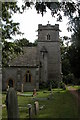
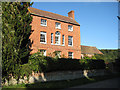
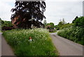
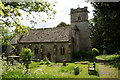
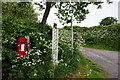
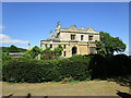
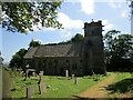
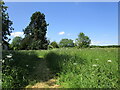
Photos of GL19 4LF


Area Information
Living in GL19 4LF offers a quiet, compact residential experience in a small cluster of homes spread across 3.0 hectares. With a population of 1,436 and a density of 44 people per square kilometre, this area feels intentionally low-key, avoiding the congestion of larger towns. The community is largely composed of middle-aged residents, with a median age of 47 and most households falling within the 30-64 age range. Daily life here is defined by proximity to essential services: nearby shops like Co-op Twigworth and Morrisons Daily cater to routine needs, while Gloucester Railway Station provides a direct link to regional transport. The area’s small size means it is easy to navigate on foot or by bike, and its low population density suggests a slower pace of life. For families, the presence of Ashleworth Church of England Primary School, rated ‘good’ by Ofsted, adds practical value. While not a bustling hub, GL19 4LF appeals to those seeking a peaceful, manageable environment with clear access to local amenities and transport links.
- Area Type
- Postcode
- Area Size
- 3.0 hectares
- Population
- 1436
- Population Density
- 44 people/km²
The property market in GL19 4LF is dominated by owner-occupied homes, with 73% of residents living in properties they own. This high rate of home ownership suggests a mature, settled community with limited rental activity. The accommodation type is exclusively houses, which is unusual for areas with higher flat or apartment density. This indicates a preference for single-family homes, likely appealing to families or individuals seeking space and privacy. Given the small size of the area—just 3.0 hectares—properties are likely to be spread out, offering larger gardens or outdoor space compared to more compact developments. For buyers, this means a focus on long-term investment in a stable, low-risk market. The absence of planning constraints or environmental restrictions further supports the feasibility of property ownership here, though the limited number of homes means the market is unlikely to be highly competitive.
House Prices in GL19 4LF
Showing 2 properties
| Address | Type | Beds | Baths | Last Sale Price | Last Sale Date | |
|---|---|---|---|---|---|---|
| Former Dovecote 40 Metres Southeast Of Hasfield Court, Hasfield Court Lane, Hasfield, Gloucester, GL19 4LF | Detached | - | - | - | - | |
| Stableblock, Hasfield Court Lane, Hasfield, Gloucester, GL19 4LF | Detached | - | - | - | - |
Energy Efficiency in GL19 4LF
The lifestyle in GL19 4LF is shaped by its proximity to essential amenities and modest scale. Within practical reach are five retail outlets, including Co-op Twigworth, Morrisons Daily, and Co-op Gloucester, providing access to groceries, household goods, and other daily necessities. The area’s single railway station, Gloucester Railway Station, connects residents to regional services, while the three nearby airports—though possibly listed redundantly—suggest potential for travel convenience. The small size of the area means that amenities are closely clustered, reducing the need for long commutes. While there is no mention of parks or leisure facilities in the data, the low population density and absence of environmental constraints imply space for outdoor activities. The combination of retail options and transport links supports a practical, low-maintenance lifestyle, ideal for those prioritising accessibility over extensive leisure opportunities.
Amenities
Schools
The primary school nearest to GL19 4LF is Ashleworth Church of England Primary School, which serves the local community with a ‘good’ Ofsted rating. This school is the only educational institution listed in the area, suggesting that families may need to travel slightly beyond GL19 4LF for secondary education. The presence of a primary school with a positive rating is a key factor for families prioritising local schooling, though the lack of secondary options may influence decisions about where to live. The school’s rating indicates a satisfactory standard of education, but parents should consider proximity to other schools if their children require additional support or specialist facilities. For those seeking a school within walking distance, GL19 4LF offers a reliable primary option, though secondary education will require travel.
| Rank | School | Type | Entry gender | Ages |
|---|
Explore more schools in this area
Go to Schools tabDemographics
The population of GL19 4LF is predominantly middle-aged, with a median age of 47 and the majority of residents aged between 30 and 64. Home ownership is high, with 73% of households owning their properties, indicating a stable, long-term community. The area is characterised by houses rather than flats, reflecting a traditional residential profile. The predominant ethnic group is White, which aligns with broader regional trends. With a population density of 44 people per square kilometre, the area avoids overcrowding, contributing to a relaxed living environment. The absence of significant deprivation data means quality of life is likely supported by the area’s low population density and access to nearby services. This demographic profile suggests a community focused on family stability and long-term residency, with limited turnover of residents.
Household Size
Accommodation Type
Tenure
Ethnic Group
Religion
Household Composition
Age
Household Deprivation
NS-SEC
Explore more demographic insights in this area
Go to Demographics tabPlanning
Planning Constraints
- Flood RiskPremium
- Ramsar Wetland SitesPremium
- Area of Outstanding Natural BeautyPremium
- Protected Nature ReservePremium
- Protected WoodlandPremium