Area Overview for GL19 4ES
Photos of GL19 4ES
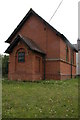
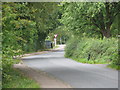
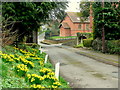
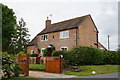
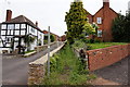
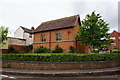
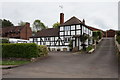
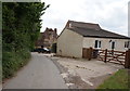
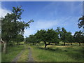
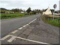

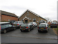
61 photos from this area
Area Information
Key information about the GL19 4ES including its size, population, and administrative classification.
- Area Type
- Postcode
- Area Size
- 12.0 hectares
- Population
- 1436
- Population Density
- 44 people/km²
House Prices in GL19 4ES
29
Properties
£308,071
Average Sold Price
£93,000
Lowest Price
£510,000
Highest Price
Showing 29 properties
| Address | Type | Beds | Baths | Last Sale Price | Last Sale Date | |
|---|---|---|---|---|---|---|
| Harley Cottage, The Street, Tirley, Gloucester, GL19 4ES | Detached | 3 | 1 | £365,000 | Oct 2024 | |
| The Old Chapel, The Street, Tirley, Gloucester, GL19 4ES | Detached | 2 | 1 | £270,000 | Jul 2024 | |
| Orchard Bank, The Street, Tirley, Gloucester, GL19 4ES | Detached | 4 | 2 | £510,000 | Jun 2024 | |
| Aprey House, The Street, Tirley, Gloucester, GL19 4ES | Retail | 2 | 2 | £487,500 | Oct 2022 | |
| Orchard House, The Street, Tirley, Gloucester, GL19 4ES | Detached | 4 | 2 | £480,000 | May 2022 | |
| Rosebank Cottage, The Street, Tirley, Gloucester, GL19 4ES | Bungalow | 4 | 1 | £305,000 | Jan 2020 | |
| Sunnybank, The Street, Tirley, Gloucester, GL19 4ES | Detached | 5 | 2 | £455,000 | Aug 2018 | |
| Wakefield, The Street, Tirley, Gloucester, GL19 4ES | Bungalow | - | - | £260,000 | Sep 2015 | |
| Bankfield House, The Street, Tirley, Gloucester, GL19 4ES | Detached | 4 | 2 | £210,000 | Apr 2014 | |
| The White House, The Street, Tirley, Gloucester, GL19 4ES | Detached | 2 | 3 | £275,000 | Apr 2006 |
Page 1 of 3
Energy Efficiency in GL19 4ES
Amenities
Schools
| Rank | School | Type | Entry gender | Ages |
|---|
Explore more schools in this area
Go to Schools tabDemographics
Household Size
Two person
most common
Accommodation Type
Houses
most common
Tenure
73
majority
Ethnic Group
White
most common
Religion
N/A
most common
Household Composition
N/A
most common
Age
47
median
Adults (30-64 years)
most common
Household Deprivation
N/A
with no deprivation
NS-SEC
40
in Lower managerial occupations
Explore more demographic insights in this area
Go to Demographics tabPlanning
Planning Constraints
- Flood RiskPremium
- Ramsar Wetland SitesPremium
- Area of Outstanding Natural BeautyPremium
- Protected Nature ReservePremium
- Protected WoodlandPremium