Area Overview for GL19 4DP
Photos of GL19 4DP

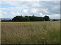
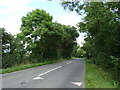

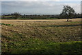
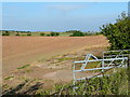

9 photos from this area
Area Information
Key information about the GL19 4DP including its size, population, and administrative classification.
- Area Type
- Postcode
- Area Size
- 39.2 hectares
- Population
- 1551
- Population Density
- 80 people/km²
House Prices in GL19 4DP
18
Properties
£487,444
Average Sold Price
£165,000
Lowest Price
£875,000
Highest Price
Showing 18 properties
| Address | Type | Beds | Baths | Last Sale Price | Last Sale Date | |
|---|---|---|---|---|---|---|
| Malt House, Wightfield, Apperley, Gloucester, GL19 4DP | Cottage | 3 | - | £535,000 | Feb 2022 | |
| Moat House, Wightfield, Apperley, Gloucester, GL19 4DP | Semi-detached | 4 | 3 | £875,000 | Dec 2020 | |
| Fermor Place, Wightfield, Apperley, Gloucester, GL19 4DP | Detached | 4 | - | £700,000 | Jan 2014 | |
| 1, Wightfield Cottage, Sawpit Lane, Apperley, Gloucester, GL19 4DP | house | 4 | - | £439,000 | Jan 2014 | |
| Rickyard Cottage, Wightfield, Apperley, Gloucester, GL19 4DP | Bungalow | 3 | - | £427,000 | Sep 2010 | |
| Saxon Cottage, Wightfield, Apperley, Gloucester, GL19 4DP | Detached | - | - | £390,000 | Aug 2008 | |
| 2, Wightfield Cottage, Sawpit Lane, Apperley, Gloucester, GL19 4DP | Terraced | - | - | £455,000 | Jun 2007 | |
| Conygree, Wightfield, Apperley, Gloucester, GL19 4DP | Detached | 5 | 3 | £401,000 | May 2006 | |
| The Neuk, Sawpit Lane, Apperley, Gloucester, GL19 4DP | assembly_leisure | - | - | £165,000 | Jul 1998 | |
| The Haven, Wightfield, Apperley, Gloucester, GL19 4DP | Detached | 5 | 3 | - | - |
Page 1 of 2
Energy Efficiency in GL19 4DP
Amenities
Schools
| Rank | School | Type | Entry gender | Ages |
|---|
Explore more schools in this area
Go to Schools tabDemographics
Household Size
Two person
most common
Accommodation Type
Houses
most common
Tenure
76
majority
Ethnic Group
White
most common
Religion
N/A
most common
Household Composition
N/A
most common
Age
47
median
Adults (30-64 years)
most common
Household Deprivation
N/A
with no deprivation
NS-SEC
39
in Lower managerial occupations
Explore more demographic insights in this area
Go to Demographics tabPlanning
Planning Constraints
- Flood RiskPremium
- Ramsar Wetland SitesPremium
- Area of Outstanding Natural BeautyPremium
- Protected Nature ReservePremium
- Protected WoodlandPremium