Area Overview for GL19 3RQ
Photos of GL19 3RQ
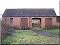
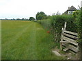
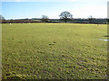
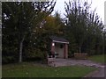
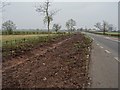


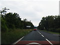
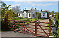
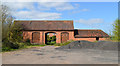
31 photos from this area
Area Information
Key information about the GL19 3RQ including its size, population, and administrative classification.
- Area Type
- Postcode
- Area Size
- 46.9 hectares
- Population
- 2612
- Population Density
- 86 people/km²
House Prices in GL19 3RQ
35
Properties
£421,545
Average Sold Price
£50,000
Lowest Price
£650,000
Highest Price
Showing 35 properties
| Address | Type | Beds | Baths | Last Sale Price | Last Sale Date | |
|---|---|---|---|---|---|---|
| South Lynn, Gloucester Road, Corse, GL19 3RQ | Bungalow | 4 | 2 | £650,000 | Mar 2024 | |
| Rylonby, Gloucester Road, Corse, GL19 3RQ | Bungalow | 3 | 2 | £637,500 | Feb 2022 | |
| Marley Hall, Gloucester Road, Corse, GL19 3RQ | Bungalow | 4 | 2 | £562,500 | Jan 2019 | |
| Corse Grange Cottage, Gloucester Road, Corse, GL19 3RQ | Cottage | 3 | 1 | £550,000 | Sep 2018 | |
| Little Fold, Gloucester Road, Corse, GL19 3RQ | Bungalow | - | - | £245,000 | May 2018 | |
| Greenways, Gloucester Road, Corse, GL19 3RQ | Bungalow | 3 | 1 | £275,000 | Feb 2016 | |
| The Poplars, Gloucester Road, Corse, GL19 3RQ | Bungalow | 3 | - | £465,000 | Sep 2014 | |
| Snigs End Cottage, Gloucester Road, Corse, GL19 3RQ | Bungalow | 3 | 1 | £422,000 | Aug 2014 | |
| Snigs Acre, Gloucester Road, Corse, GL19 3RQ | house | 5 | - | £530,000 | Nov 2013 | |
| Hazeldene, Gloucester Road, Corse, GL19 3RQ | Bungalow | - | - | £250,000 | Dec 2001 |
Page 1 of 4
Energy Efficiency in GL19 3RQ
Amenities
Schools
| Rank | School | Type | Entry gender | Ages |
|---|
Explore more schools in this area
Go to Schools tabDemographics
Household Size
Two person
most common
Accommodation Type
Houses
most common
Tenure
82
majority
Ethnic Group
White
most common
Religion
N/A
most common
Household Composition
N/A
most common
Age
22
median
Young Adults (15-29 years)
most common
Household Deprivation
N/A
with no deprivation
NS-SEC
24
in Lower managerial occupations
Explore more demographic insights in this area
Go to Demographics tabPlanning
Planning Constraints
- Flood RiskPremium
- Ramsar Wetland SitesPremium
- Area of Outstanding Natural BeautyPremium
- Protected Nature ReservePremium
- Protected WoodlandPremium