Area Overview for GL19 3AQ
Photos of GL19 3AQ
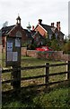
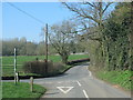
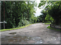


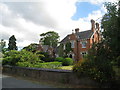
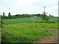
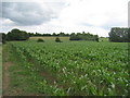

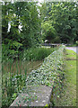
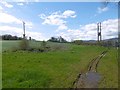
17 photos from this area
Area Information
Key information about the GL19 3AQ including its size, population, and administrative classification.
- Area Type
- Postcode
- Area Size
- 94.7 hectares
- Population
- 1688
- Population Density
- 52 people/km²
House Prices in GL19 3AQ
24
Properties
£484,921
Average Sold Price
£275,000
Lowest Price
£930,000
Highest Price
Showing 24 properties
| Address | Type | Beds | Baths | Last Sale Price | Last Sale Date | |
|---|---|---|---|---|---|---|
| Old School House, Tibberton Lane, Tibberton, GL19 3AQ | Detached | - | - | £930,000 | Mar 2022 | |
| Lowlands, Tibberton Lane, Tibberton, GL19 3AQ | house | 5 | - | £702,000 | Jul 2021 | |
| Fir Tree Cottage, Tibberton Lane, Tibberton, GL19 3AQ | Semi-detached | 3 | 1 | £325,000 | Sep 2020 | |
| Limetree Cottage, Tibberton Lane, Tibberton, GL19 3AQ | Detached | 4 | 2 | £540,000 | Sep 2020 | |
| Yew Tree Cottage, Tibberton Lane, Tibberton, GL19 3AQ | Semi-detached | 3 | 1 | £292,450 | Dec 2016 | |
| Wynford House, Tibberton Lane, Tibberton, GL19 3AQ | house | - | - | £330,000 | Jun 2012 | |
| Woodcroft, Tibberton Lane, Tibberton, GL19 3AQ | Detached | - | - | £275,000 | Dec 2000 | |
| Lawbara, Tibberton Lane, Tibberton, GL19 3AQ | Detached | 5 | 3 | - | - | |
| The Poplars, Tibberton Lane, Tibberton, GL19 3AQ | Detached | 5 | 1 | - | - | |
| Wades End, Lower Farm, Tibberton Lane, Tibberton, GL19 3AQ | Detached | 5 | 2 | - | - |
Page 1 of 3
Energy Efficiency in GL19 3AQ
Amenities
Schools
| Rank | School | Type | Entry gender | Ages |
|---|
Explore more schools in this area
Go to Schools tabDemographics
Household Size
Two person
most common
Accommodation Type
Houses
most common
Tenure
83
majority
Ethnic Group
White
most common
Religion
N/A
most common
Household Composition
N/A
most common
Age
47
median
Adults (30-64 years)
most common
Household Deprivation
N/A
with no deprivation
NS-SEC
42
in Lower managerial occupations
Explore more demographic insights in this area
Go to Demographics tabPlanning
Planning Constraints
- Flood RiskPremium
- Ramsar Wetland SitesPremium
- Area of Outstanding Natural BeautyPremium
- Protected Nature ReservePremium
- Protected WoodlandPremium