Area Overview for GL18 1EJ
Photos of GL18 1EJ
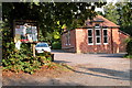
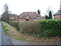
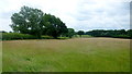
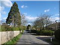
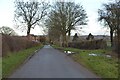
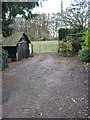
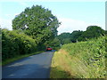
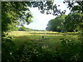
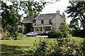
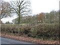
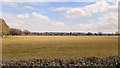
11 photos from this area
Area Information
Key information about the GL18 1EJ including its size, population, and administrative classification.
- Area Type
- Postcode
- Area Size
- 29.3 hectares
- Population
- 2612
- Population Density
- 86 people/km²
House Prices in GL18 1EJ
32
Properties
£283,700
Average Sold Price
£82,500
Lowest Price
£480,000
Highest Price
Showing 32 properties
| Address | Type | Beds | Baths | Last Sale Price | Last Sale Date | |
|---|---|---|---|---|---|---|
| Ivy Cottage, Gloucester Road, Upleadon, GL18 1EJ | house | - | - | £480,000 | Sep 2021 | |
| Treelands, Gloucester Road, Upleadon, GL18 1EJ | Detached | 4 | 1 | £455,000 | Jul 2019 | |
| Woodside, Gloucester Road, Upleadon, GL18 1EJ | Cottage | 2 | 1 | £284,000 | Apr 2013 | |
| Spring Barton, Gloucester Road, Upleadon, GL18 1EJ | house | 4 | - | £277,500 | Jul 2012 | |
| The Croft, Gloucester Road, Upleadon, GL18 1EJ | Bungalow | - | - | £168,000 | Oct 2011 | |
| Hoglet Cottage, Gloucester Road, Upleadon, GL18 1EJ | Semi-detached | - | - | £395,000 | Apr 2006 | |
| Underleaf, Gloucester Road, Upleadon, GL18 1EJ | Detached | - | - | £385,000 | May 2004 | |
| Woodend, Gloucester Road, Upleadon, GL18 1EJ | Detached | - | - | £200,000 | Jun 2002 | |
| Cherry Tree Cottage, Gloucester Road, Upleadon, GL18 1EJ | Detached | - | - | £82,500 | Feb 2000 | |
| Silver Birches, Gloucester Road, Upleadon, GL18 1EJ | Detached | - | - | £110,000 | Mar 1995 |
Page 1 of 4
Energy Efficiency in GL18 1EJ
Amenities
Schools
| Rank | School | Type | Entry gender | Ages |
|---|
Explore more schools in this area
Go to Schools tabDemographics
Household Size
Two person
most common
Accommodation Type
Houses
most common
Tenure
82
majority
Ethnic Group
White
most common
Religion
N/A
most common
Household Composition
N/A
most common
Age
22
median
Young Adults (15-29 years)
most common
Household Deprivation
N/A
with no deprivation
NS-SEC
24
in Lower managerial occupations
Explore more demographic insights in this area
Go to Demographics tabPlanning
Planning Constraints
- Flood RiskPremium
- Ramsar Wetland SitesPremium
- Area of Outstanding Natural BeautyPremium
- Protected Nature ReservePremium
- Protected WoodlandPremium