Area Overview for GL17 9XD
Photos of GL17 9XD
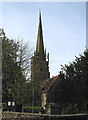
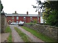
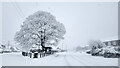
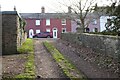
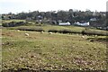
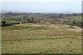
100 photos from this area
Area Information
Key information about the GL17 9XD including its size, population, and administrative classification.
- Area Type
- Postcode
- Area Size
- 6.6 hectares
- Population
- 1813
- Population Density
- 262 people/km²
House Prices in GL17 9XD
22
Properties
£202,814
Average Sold Price
£76,000
Lowest Price
£450,000
Highest Price
Showing 22 properties
| Address | Type | Beds | Baths | Last Sale Price | Last Sale Date | |
|---|---|---|---|---|---|---|
| Brambley Hedge, Varnister Road, Ruardean, GL17 9XD | Detached | 5 | 2 | £450,000 | Jun 2024 | |
| Treetops, Varnister Road, Ruardean, GL17 9XD | Detached | - | - | £318,000 | Jul 2021 | |
| 8 Varnister Road, Ruardean, GL17 9XD | Bungalow | 3 | 1 | £216,000 | May 2020 | |
| 14 Varnister Road, Ruardean, GL17 9XD | Semi-detached | 2 | 1 | £165,000 | Aug 2019 | |
| 10 Varnister Road, Ruardean, GL17 9XD | Semi-detached | 3 | 1 | £173,000 | Jul 2018 | |
| 18 Varnister Road, Ruardean, GL17 9XD | Semi-detached | 3 | 2 | £209,000 | Nov 2016 | |
| 16 Varnister Road, Ruardean, GL17 9XD | Semi-detached | 3 | - | £167,000 | Jan 2013 | |
| 22 Varnister Road, Ruardean, GL17 9XD | Bungalow | - | - | £203,000 | Sep 2005 | |
| 4 Varnister Road, Ruardean, GL17 9XD | Semi-detached | - | - | £94,950 | Jul 2003 | |
| Clarewood, Varnister Road, Ruardean, GL17 9XD | Detached | - | - | £159,000 | Jun 2000 |
Page 1 of 3
Energy Efficiency in GL17 9XD
Amenities
Schools
| Rank | School | Type | Entry gender | Ages |
|---|
Explore more schools in this area
Go to Schools tabDemographics
Household Size
Two person
most common
Accommodation Type
Houses
most common
Tenure
89
majority
Ethnic Group
White
most common
Religion
N/A
most common
Household Composition
N/A
most common
Age
47
median
Adults (30-64 years)
most common
Household Deprivation
N/A
with no deprivation
NS-SEC
33
in Lower managerial occupations
Explore more demographic insights in this area
Go to Demographics tabPlanning
Planning Constraints
- Flood RiskPremium
- Ramsar Wetland SitesPremium
- Area of Outstanding Natural BeautyPremium
- Protected Nature ReservePremium
- Protected WoodlandPremium