Area Overview for GL17 9SU
Photos of GL17 9SU
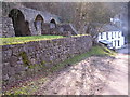

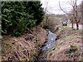
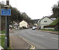
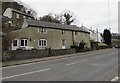
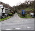
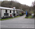
45 photos from this area
Area Information
Key information about the GL17 9SU including its size, population, and administrative classification.
- Area Type
- Postcode
- Area Size
- 37.3 hectares
- Population
- 1434
- Population Density
- 352 people/km²
House Prices in GL17 9SU
21
Properties
£384,778
Average Sold Price
£170,000
Lowest Price
£775,000
Highest Price
Showing 21 properties
| Address | Type | Beds | Baths | Last Sale Price | Last Sale Date | |
|---|---|---|---|---|---|---|
| Cidermill House, The Moorwood, Lydbrook, GL17 9SU | Semi-detached | 3 | - | £170,000 | Jun 2024 | |
| Moorwood Farm House, The Moorwood, Lydbrook, GL17 9SU | Retail | 6 | 3 | £775,000 | Aug 2022 | |
| Spring Cottage, The Moorwood, Lydbrook, GL17 9SU | Retail | 5 | 1 | £675,000 | Jun 2022 | |
| Goodrich House, The Moorwood, Lydbrook, GL17 9SU | Detached | 4 | - | £335,000 | Jan 2018 | |
| Colebrooks, The Moorwood, Lydbrook, GL17 9SU | Detached | 5 | - | £450,000 | Oct 2016 | |
| Morang, The Moorwood, Lydbrook, GL17 9SU | Bungalow | 3 | - | £260,000 | Mar 2015 | |
| The Mead, The Moorwood, Lydbrook, GL17 9SU | house | - | - | £229,000 | Jul 2014 | |
| Bonds Cottage, The Moorwood, Lydbrook, GL17 9SU | Detached | - | - | £204,000 | Aug 2007 | |
| High View, The Moorwood, Lydbrook, GL17 9SU | Detached | - | - | £365,000 | Mar 2005 | |
| Knoll Cottage, The Moorwood, Lydbrook, GL17 9SU | Detached | 3 | 2 | - | - |
Page 1 of 3
Energy Efficiency in GL17 9SU
Amenities
Schools
| Rank | School | Type | Entry gender | Ages |
|---|
Explore more schools in this area
Go to Schools tabDemographics
Household Size
Two person
most common
Accommodation Type
Houses
most common
Tenure
66
majority
Ethnic Group
White
most common
Religion
N/A
most common
Household Composition
N/A
most common
Age
47
median
Adults (30-64 years)
most common
Household Deprivation
N/A
with no deprivation
NS-SEC
25
in Lower managerial occupations
Explore more demographic insights in this area
Go to Demographics tabPlanning
Planning Constraints
- Flood RiskPremium
- Ramsar Wetland SitesPremium
- Protected Nature ReservePremium
- Protected WoodlandPremium