Area Overview for GL17 9NP
Photos of GL17 9NP
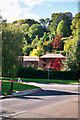
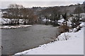
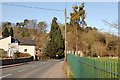
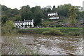
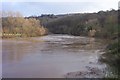
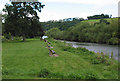
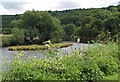
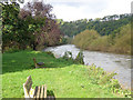

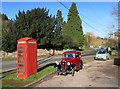
100 photos from this area
Area Information
Key information about the GL17 9NP including its size, population, and administrative classification.
- Area Type
- Postcode
- Area Size
- 3662 m²
- Population
- 1665
- Population Density
- 377 people/km²
House Prices in GL17 9NP
5
Properties
£187,167
Average Sold Price
£154,000
Lowest Price
£243,000
Highest Price
Showing 5 properties
| Address | Type | Beds | Baths | Last Sale Price | Last Sale Date | |
|---|---|---|---|---|---|---|
| 23 Forge Row, Lower Lydbrook, Lydbrook, GL17 9NP | Terraced | 3 | 1 | £164,500 | Jan 2017 | |
| 25 Forge Row, Lower Lydbrook, Lydbrook, GL17 9NP | house | - | - | £154,000 | Mar 2012 | |
| Rubblestones, Forge Row, Lower Lydbrook, Lydbrook, GL17 9NP | Semi-detached | - | - | £243,000 | Dec 2005 | |
| Managers Accomodation, Forge Hammer Inn, Forge Row, Lower Lydbrook, Lydbrook, GL17 9NP | Flat | - | - | - | - | |
| Forge Hammer Inn, Forge Row, Lower Lydbrook, Lydbrook, GL17 9NP | Leisure | - | - | - | - |
Energy Efficiency in GL17 9NP
Amenities
Schools
| Rank | School | Type | Entry gender | Ages |
|---|
Explore more schools in this area
Go to Schools tabDemographics
Household Size
Two person
most common
Accommodation Type
Houses
most common
Tenure
81
majority
Ethnic Group
White
most common
Religion
N/A
most common
Household Composition
N/A
most common
Age
47
median
Adults (30-64 years)
most common
Household Deprivation
N/A
with no deprivation
NS-SEC
34
in Lower managerial occupations
Explore more demographic insights in this area
Go to Demographics tabPlanning
Planning Constraints
- Flood RiskPremium
- Ramsar Wetland SitesPremium
- Protected Nature ReservePremium
- Protected WoodlandPremium