Area Overview for GL17 9NJ
Photos of GL17 9NJ


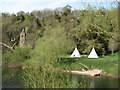

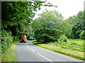
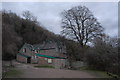
100 photos from this area
Area Information
Key information about the GL17 9NJ including its size, population, and administrative classification.
- Area Type
- Postcode
- Area Size
- 18.2 hectares
- Population
- 1665
- Population Density
- 377 people/km²
House Prices in GL17 9NJ
15
Properties
£299,909
Average Sold Price
£171,500
Lowest Price
£400,000
Highest Price
Showing 15 properties
| Address | Type | Beds | Baths | Last Sale Price | Last Sale Date | |
|---|---|---|---|---|---|---|
| Wylde Green, Stowfield Road, Lydbrook, GL17 9NJ | Bungalow | 4 | 5 | £400,000 | Nov 2024 | |
| 1, Wye Bank Cottages, Stowfield Road, Lydbrook, GL17 9NJ | Semi-detached | 1 | 1 | £171,500 | Oct 2023 | |
| Greenway Cottage, Stowfield Road, Lydbrook, GL17 9NJ | Detached | 2 | 1 | £400,000 | Oct 2022 | |
| Royds, Stowfield Road, Lydbrook, GL17 9NJ | Retail | 3 | 3 | £390,000 | Sep 2022 | |
| Ferndale, Stowfield Road, Lydbrook, GL17 9NJ | Bungalow | 3 | 1 | £295,000 | Mar 2020 | |
| Lavernock, Stowfield Road, Lydbrook, GL17 9NJ | Bungalow | 2 | 2 | £345,000 | Sep 2019 | |
| Wye View, Stowfield Road, Lydbrook, GL17 9NJ | Detached | 3 | - | £345,000 | Apr 2018 | |
| Longlast, Stowfield Road, Lydbrook, GL17 9NJ | house | 4 | - | £247,000 | Mar 2016 | |
| Clairewood, Stowfield Road, Lydbrook, GL17 9NJ | Bungalow | 3 | - | £231,500 | Nov 2013 | |
| Park View, Stowfield Road, Lydbrook, GL17 9NJ | house | 3 | - | £180,000 | Mar 2012 |
Page 1 of 2
Energy Efficiency in GL17 9NJ
Amenities
Schools
| Rank | School | Type | Entry gender | Ages |
|---|
Explore more schools in this area
Go to Schools tabDemographics
Household Size
Two person
most common
Accommodation Type
Houses
most common
Tenure
81
majority
Ethnic Group
White
most common
Religion
N/A
most common
Household Composition
N/A
most common
Age
47
median
Adults (30-64 years)
most common
Household Deprivation
N/A
with no deprivation
NS-SEC
34
in Lower managerial occupations
Explore more demographic insights in this area
Go to Demographics tabPlanning
Planning Constraints
- Flood RiskPremium
- Ramsar Wetland SitesPremium
- Protected Nature ReservePremium
- Protected WoodlandPremium