Area Overview for GL17 9LD
Photos of GL17 9LD


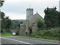


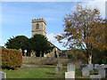
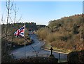
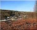


86 photos from this area
Area Information
Key information about the GL17 9LD including its size, population, and administrative classification.
- Area Type
- Postcode
- Area Size
- 4.4 hectares
- Population
- 1887
- Population Density
- 544 people/km²
House Prices in GL17 9LD
26
Properties
£267,000
Average Sold Price
£127,500
Lowest Price
£490,000
Highest Price
Showing 26 properties
| Address | Type | Beds | Baths | Last Sale Price | Last Sale Date | |
|---|---|---|---|---|---|---|
| The Cottage, Trinity Road, Harrow Hill, GL17 9LD | Cottage | 2 | 1 | £235,000 | Jul 2023 | |
| Ruffin House, Trinity Road, Harrow Hill, GL17 9LD | Detached | 3 | 1 | £425,000 | Aug 2022 | |
| Chapel House, Trinity Road, Harrow Hill, GL17 9LD | Land | 3 | 1 | £340,000 | May 2021 | |
| Winterfold, Trinity Road, Harrow Hill, GL17 9LD | house | - | - | £490,000 | May 2021 | |
| West View, Trinity Road, Harrow Hill, GL17 9LD | Semi-detached | 3 | 2 | £197,000 | May 2020 | |
| Chrinda, Trinity Road, Harrow Hill, GL17 9LD | Detached | 3 | 2 | £325,000 | Nov 2019 | |
| The White House, Trinity Road, Harrow Hill, GL17 9LD | Detached | 6 | 2 | £432,000 | Nov 2018 | |
| Windyridge, Trinity Road, Harrow Hill, GL17 9LD | house | 3 | - | £286,000 | Nov 2016 | |
| Ashleigh Cottage, Trinity Road, Harrow Hill, GL17 9LD | Semi-detached | 3 | - | £185,000 | Sep 2011 | |
| Rose Cottage, Trinity Road, Harrow Hill, GL17 9LD | house | - | - | £150,000 | Jul 2009 |
Page 1 of 3
Energy Efficiency in GL17 9LD
Amenities
Schools
| Rank | School | Type | Entry gender | Ages |
|---|
Explore more schools in this area
Go to Schools tabDemographics
Household Size
Two person
most common
Accommodation Type
Houses
most common
Tenure
76
majority
Ethnic Group
White
most common
Religion
N/A
most common
Household Composition
N/A
most common
Age
47
median
Adults (30-64 years)
most common
Household Deprivation
N/A
with no deprivation
NS-SEC
26
in Lower managerial occupations
Explore more demographic insights in this area
Go to Demographics tabPlanning
Planning Constraints
- Flood RiskPremium
- Ramsar Wetland SitesPremium
- Area of Outstanding Natural BeautyPremium
- Protected Nature ReservePremium
- Protected WoodlandPremium