Area Overview for GL17 9HL
Photos of GL17 9HL
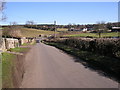

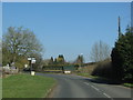
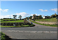
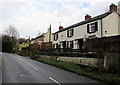
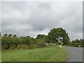
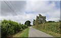
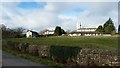
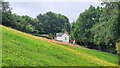
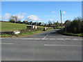
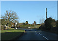

27 photos from this area
Area Information
Key information about the GL17 9HL including its size, population, and administrative classification.
- Area Type
- Postcode
- Area Size
- 3.4 hectares
- Population
- 1887
- Population Density
- 544 people/km²
House Prices in GL17 9HL
25
Properties
£217,500
Average Sold Price
£125,000
Lowest Price
£300,000
Highest Price
Showing 25 properties
| Address | Type | Beds | Baths | Last Sale Price | Last Sale Date | |
|---|---|---|---|---|---|---|
| Candlelight Cottage, Hillside Road, Drybrook, GL17 9HL | Cottage | 2 | 1 | £175,000 | May 2022 | |
| Rose Cottage, Hillside Road, Drybrook, GL17 9HL | Detached | 3 | 2 | £245,000 | Oct 2020 | |
| Forest View Bungalow, Hillside Road, Drybrook, GL17 9HL | Bungalow | 2 | 1 | £300,000 | Jun 2018 | |
| Woodview, Hillside Road, Drybrook, GL17 9HL | Cottage | 3 | 2 | £222,500 | Jul 2016 | |
| Heasley Cottage, Hillside Road, Drybrook, GL17 9HL | Cottage | 3 | 1 | £210,000 | Nov 2013 | |
| Hillview, Hillside Road, Drybrook, GL17 9HL | Detached | - | - | £245,000 | Sep 2007 | |
| Lorna Doone, Hillside Road, Drybrook, GL17 9HL | Semi-detached | - | - | £125,000 | Aug 2006 | |
| 6 Hillside Road, Drybrook, GL17 9HL | Terraced | 2 | 1 | - | - | |
| 1 Hillside Road, Drybrook, GL17 9HL | Terraced | 2 | 1 | - | - | |
| Ty Taf Harley, Hillside Road, Drybrook, GL17 9HL | Detached | - | - | - | - |
Page 1 of 3
Energy Efficiency in GL17 9HL
Amenities
Schools
| Rank | School | Type | Entry gender | Ages |
|---|
Explore more schools in this area
Go to Schools tabDemographics
Household Size
Two person
most common
Accommodation Type
Houses
most common
Tenure
76
majority
Ethnic Group
White
most common
Religion
N/A
most common
Household Composition
N/A
most common
Age
47
median
Adults (30-64 years)
most common
Household Deprivation
N/A
with no deprivation
NS-SEC
26
in Lower managerial occupations
Explore more demographic insights in this area
Go to Demographics tabPlanning
Planning Constraints
- Flood RiskPremium
- Ramsar Wetland SitesPremium
- Area of Outstanding Natural BeautyPremium
- Protected Nature ReservePremium
- Protected WoodlandPremium