Area Overview for GL17 9AG
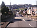
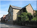
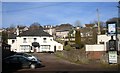
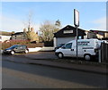
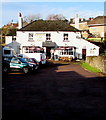
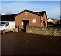
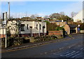
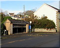
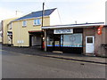
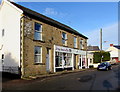
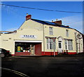
Photos of GL17 9AG

Area Information
GL17 9AG represents a specific residential cluster covering 4685 square metres within the England postcode system. This small area houses a population of 1887 people, resulting in a population density of 544 people per square kilometre. You will find a tight-knit community where neighbours are likely to know one another due to the limited physical space and concentrated housing. Daily life here revolves around a stable environment where residents have access to essential local services without the congestion found in larger towns. The area offers a quiet setting suitable for those seeking a settled location away from major urban sprawl. Living in GL17 9AG means benefiting from a manageable neighbourhood size where household coherence is high. The layout supports a lifestyle focused on proximity to home rather than long commutes to distant town centres. You can expect a straightforward living experience where the community boundaries are well-defined and easily navigable. This postcode serves as a distinct residential pocket rather than a sprawling district, offering residents a clear sense of locality. The compact nature of the 4685 square metre footprint ensures that infrastructure is designed for immediate accessibility. Families and individuals alike appreciate the clear limits of the area which provide a defined home environment.
- Area Type
- Postcode
- Area Size
- 4685 m²
- Population
- 1887
- Population Density
- 544 people/km²
This area markets itself as a stable, owner-occupied community where 76 per cent of residents own their homes. The allocation of accommodation types shows that houses are the primary housing stock, with apartments being a minor or non-existent feature in this specific postcode. This dominance of independent houses shapes the property market by favouring family homes over flat living. Buyers looking for homes in GL17 9AG will find a market characterised by long-term ownership rather than a high turnover of rentals. The high ownership rate indicates that many properties have been in caring hands for extended periods. This stability often translates to consistent estate values and a predictable market for those wishing to buy. You should expect a traditional housing landscape where land ownership and garden space are valued metrics. The market does not currently suggest a proliferation of multi-unit developments or rental blocks. Instead, it presents options for purchasing standalone homes suitable for the area's demographic needs. The property stock is tailored to the preferences of the 76 per cent who have already made the choice to buy.
House Prices in GL17 9AG
Showing 8 properties
| Address | Type | Beds | Baths | Last Sale Price | Last Sale Date | |
|---|---|---|---|---|---|---|
| 2, The Halt, Quabbs Road, Drybrook, GL17 9AG | Semi-detached | 2 | 1 | £192,000 | Mar 2024 | |
| Parva Dene, Quabbs Road, Drybrook, GL17 9AG | Detached | 4 | 3 | £350,000 | Jul 2022 | |
| Tonelda, Quabbs Road, Drybrook, GL17 9AG | Bungalow | - | - | £105,000 | Aug 2013 | |
| Rose Villa, Quabbs Road, Drybrook, GL17 9AG | house | 4 | 1 | £155,000 | May 2013 | |
| Claremont, Quabbs Road, Drybrook, GL17 9AG | Bungalow | - | - | £148,000 | Jun 2009 | |
| Plot 2 Land At, Tonelda, Quabbs Road, Drybrook, GL17 9AG | Land | - | - | - | - | |
| Plot 1 Land At, Tonelda, Quabbs Road, Drybrook, GL17 9AG | Detached | - | - | - | - | |
| 1, The Halt, Quabbs Road, Drybrook, GL17 9AG | Semi-detached | - | - | - | - |
Energy Efficiency in GL17 9AG
Residents of GL17 9AG enjoy access to a selection of retail and transport amenities within practical reach. There are 5 nearby retail locations, including Co-op Drybrook, Co-op Mitcheldean, and Co-op Valley. These supermarkets provide essential shopping needs without requiring long drives to larger town centres. For transportation, the area benefits from 2 metro-style railway stations: Dean Forest Railway and Parkend. These transport nodes facilitate day trips to nearby towns and connection to wider rail networks. The presence of three Co-op branches highlights a strong commercial presence dedicated to everyday needs. Living in GL17 9AG allows you to combine local shopping with regional travel from convenient rail access. Dining options are frequently linked to these retail hubs, offering casual meals alongside grocery collection. The proximity to Dean Forest Railway and Parkend enhances the area's connectivity to the surrounding forest and industrial zones. This blend of retail convenience and rail access supports a balanced lifestyle where daily errands and longer journeys are manageable. You do not need to travel far for essentials or regional exploration.
Amenities
Schools
Drybrook Primary School stands as the key educational facility for families residing in GL17 9AG. This institution operates as a primary school and holds a 'good' Ofsted rating, confirming its operational standards. The presence of a single primary school listed in the immediate vicinity suggests a focused educational offering for young children. You will not find secondary schools or further education colleges listed directly within the core data for this specific postcode. The concentration on one primary option means that families must plan their educational routes carefully once children progress beyond primary age. The 'good' rating provides reassurance regarding the quality of early education available in the neighbourhood. Living in GL17 9AG involves relying on Drybrook Primary School for the first stage of compulsory education. While no other schools appear in the provided data, this named entity remains the dedicated educational anchor for the local community. Parents looking at schools near GL17 9AG should prioritise Drybrook Primary School for early-year planning.
| Rank | School | Type | Entry gender | Ages |
|---|
Explore more schools in this area
Go to Schools tabDemographics
The community in GL17 9AG is defined by a mature demographic profile with a median age of 47 years. The most common age range consists of adults between 30 and 64 years, indicating a stable workforce and family structure. House ownership stands at 76 per cent, reflecting a strong preference for buying rather than renting within this locale. The accommodation type is predominantly houses, reinforcing the character of this residential zone as a family-oriented neighbourhood. The predominant ethnic group is White, which aligns with the broader demographic trends of many established English settlements. This high level of home ownership at 76 per cent suggests financial stability among residents and a deep local investment in the property market. The age profile supports schools and community activities geared towards raising children and supporting adult life. Living in GL17 9AG involves joining a community where the majority of adults are established in their residences. The lack of significant younger or older demographic outliers points to a consistent, long-term residential area. These figures show an area where people have stayed, built careers, and secured their homes. The data confirms a neighbourhood built on permanence rather than transient living arrangements.
Household Size
Accommodation Type
Tenure
Ethnic Group
Religion
Household Composition
Age
Household Deprivation
NS-SEC
Explore more demographic insights in this area
Go to Demographics tabPlanning
Planning Constraints
- Flood RiskPremium
- Ramsar Wetland SitesPremium
- Area of Outstanding Natural BeautyPremium
- Protected Nature ReservePremium
- Protected WoodlandPremium