Area Overview for GL17 0XY
Photos of GL17 0XY
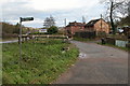
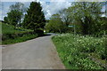
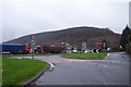
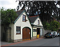
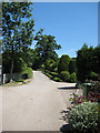
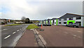
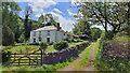
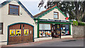
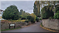
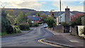
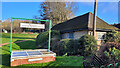
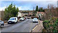
67 photos from this area
Area Information
Key information about the GL17 0XY including its size, population, and administrative classification.
- Area Type
- Postcode
- Area Size
- 5363 m²
- Population
- 1817
- Population Density
- 90 people/km²
House Prices in GL17 0XY
7
Properties
£284,992
Average Sold Price
£200,000
Lowest Price
£425,000
Highest Price
Showing 7 properties
| Address | Type | Beds | Baths | Last Sale Price | Last Sale Date | |
|---|---|---|---|---|---|---|
| 1 Casita Drive, Longhope, GL17 0XY | Bungalow | 3 | 3 | £425,000 | Aug 2024 | |
| 4 Casita Drive, Longhope, GL17 0XY | Bungalow | 3 | 1 | £329,950 | May 2019 | |
| 5 Casita Drive, Longhope, GL17 0XY | Bungalow | - | - | £230,000 | Feb 2012 | |
| 6 Casita Drive, Longhope, GL17 0XY | Bungalow | - | - | £200,000 | Dec 2011 | |
| 2 Casita Drive, Longhope, GL17 0XY | Bungalow | - | - | £265,000 | Nov 2011 | |
| 3 Casita Drive, Longhope, GL17 0XY | Bungalow | - | - | £260,000 | Nov 2011 | |
| Former Casita, Latchen, Longhope, GL17 0XY | undefined | - | - | - | - |
Energy Efficiency in GL17 0XY
Amenities
Schools
| Rank | School | Type | Entry gender | Ages |
|---|
Explore more schools in this area
Go to Schools tabDemographics
Household Size
Two person
most common
Accommodation Type
Houses
most common
Tenure
86
majority
Ethnic Group
White
most common
Religion
N/A
most common
Household Composition
N/A
most common
Age
47
median
Adults (30-64 years)
most common
Household Deprivation
N/A
with no deprivation
NS-SEC
37
in Lower managerial occupations
Explore more demographic insights in this area
Go to Demographics tabPlanning
Planning Constraints
- Flood RiskPremium
- Ramsar Wetland SitesPremium
- Area of Outstanding Natural BeautyPremium
- Protected Nature ReservePremium
- Protected WoodlandPremium