Area Overview for GL17 0AQ
Photos of GL17 0AQ


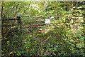
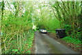


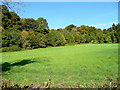


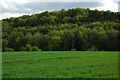
Area Information
Living in GL17 0AQ offers a compact, residential experience shaped by its 12.2-hectare footprint and population of 1,817. This postcode area, centred around a small cluster of homes, reflects a mature community with a median age of 47. The area is predominantly occupied by homeowners, with 86% of properties owned by residents, and most dwellings are houses rather than flats. Daily life here is characterised by a quiet, low-density environment, with a population density of 90 people per square kilometre. The area’s proximity to nearby towns and amenities provides a balance between seclusion and accessibility. While it lacks major urban infrastructure, its small size fosters a close-knit feel. Residents benefit from a mix of local services and natural surroundings, with no significant environmental constraints like AONB or Ramsar sites. However, the presence of protected nature reserves nearby may influence development. For those seeking a stable, low-maintenance lifestyle, GL17 0AQ offers a straightforward, unpretentious living experience.
- Area Type
- Postcode
- Area Size
- 12.2 hectares
- Population
- 1817
- Population Density
- 90 people/km²
The property market in GL17 0AQ is dominated by owner-occupied homes, with 86% of properties owned by residents. This high home ownership rate indicates a stable, long-term demographic, with little reliance on the rental sector. The area’s housing stock is predominantly composed of houses, which is typical for small, low-density postcodes. This mix of factors suggests a market where properties are likely to retain value, as demand from existing residents outstrips the need for new developments. However, the small size of the area—just 12.2 hectares—means the number of available properties is limited. Buyers should consider the immediate surrounding areas for broader options. The focus on houses rather than flats also implies a preference for private, spacious living, which may appeal to families or those seeking a quieter lifestyle.
House Prices in GL17 0AQ
Showing 1 properties
| Address | Type | Beds | Baths | Last Sale Price | Last Sale Date | |
|---|---|---|---|---|---|---|
| Blaisdon Hall, Road From Blaisdon Lane To Velthouse Lane, Blaisdon, GL17 0AQ | Retail | 11 | 7 | - | - |
Energy Efficiency in GL17 0AQ
The lifestyle in GL17 0AQ is shaped by its proximity to local retail amenities, including Morrisons Daily, Budgens Huntley, and Co-op Mitcheldean. These stores provide essential shopping options for residents, reducing the need to travel to larger towns. The area’s small size means these amenities are within practical reach, contributing to a convenient, self-contained daily life. While the data does not mention dining or leisure facilities, the presence of multiple retail outlets suggests a focus on practicality over luxury. The lack of detailed information on parks or recreational spaces means the area’s green spaces remain undefined. For those prioritising ease of access to basic services, GL17 0AQ offers a functional, low-maintenance lifestyle with minimal reliance on external infrastructure.
Amenities
Schools
Residents of GL17 0AQ have access to a range of primary schools, including Hopes Hill Community Primary School, Longhope Church of England Primary School, Hope Brook CofE Primary School, and The Salesian School, which is independent. The presence of both state and independent options provides flexibility for families, though the data does not include Ofsted ratings. The concentration of primary schools suggests the area is well-served for younger children, with multiple choices to suit different educational preferences. However, the absence of secondary schools nearby may require families to travel to adjacent towns for higher education. The mix of school types reflects a balance between public and private education, but the limited data means further research is needed to assess quality.
| Rank | School | Type | Entry gender | Ages |
|---|
Explore more schools in this area
Go to Schools tabDemographics
The community in GL17 0AQ is largely composed of adults aged 30–64, with a median age of 47. This suggests a mature, established population, likely with long-term ties to the area. Home ownership is high, at 86%, indicating a preference for settled living over rental tenancies. The predominant accommodation type is houses, which aligns with the area’s low population density. The ethnic composition is overwhelmingly White, with no data provided on other groups. The population density of 90 people per square kilometre means the area is neither overcrowded nor sparse, offering a moderate level of social interaction without urban congestion. This demographic profile suggests a community focused on stability, with limited diversity in age or background. For prospective buyers, this translates to a market where properties are likely to remain in private hands, reducing the likelihood of frequent turnover or speculative investment.
Household Size
Accommodation Type
Tenure
Ethnic Group
Religion
Household Composition
Age
Household Deprivation
NS-SEC
Explore more demographic insights in this area
Go to Demographics tabPlanning
Planning Constraints
- Flood RiskPremium
- Ramsar Wetland SitesPremium
- Area of Outstanding Natural BeautyPremium
- Protected Nature ReservePremium
- Protected WoodlandPremium