Area Overview for GL15 6DA
Photos of GL15 6DA
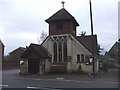
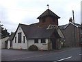
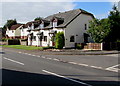
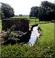
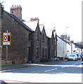
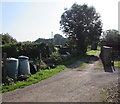
100 photos from this area
Area Information
Key information about the GL15 6DA including its size, population, and administrative classification.
- Area Type
- Postcode
- Area Size
- 2559 m²
- Population
- 1571
- Population Density
- 83 people/km²
House Prices in GL15 6DA
9
Properties
£111,937
Average Sold Price
£44,250
Lowest Price
£199,999
Highest Price
Showing 9 properties
| Address | Type | Beds | Baths | Last Sale Price | Last Sale Date | |
|---|---|---|---|---|---|---|
| 16 High Street, Aylburton, GL15 6DA | house | - | - | £115,000 | Mar 2011 | |
| 20 High Street, Aylburton, GL15 6DA | Terraced | - | - | £199,999 | Jul 2009 | |
| 14A High Street, Aylburton, GL15 6DA | Semi-detached | - | - | £88,500 | Sep 2002 | |
| 16A High Street, Aylburton, GL15 6DA | Semi-detached | - | - | £44,250 | Dec 1997 | |
| 18 High Street, Aylburton, GL15 6DA | Detached | 3 | 1 | - | - | |
| 26 High Street, Aylburton, GL15 6DA | Detached | 2 | 1 | - | - | |
| 24 High Street, Aylburton, GL15 6DA | Terraced | - | - | - | - | |
| 14 High Street, Aylburton, GL15 6DA | Semi-detached | - | - | - | - | |
| 22 High Street, Aylburton, GL15 6DA | Terraced | - | - | - | - |
Energy Efficiency in GL15 6DA
Amenities
Schools
| Rank | School | Type | Entry gender | Ages |
|---|
Explore more schools in this area
Go to Schools tabDemographics
Household Size
Two person
most common
Accommodation Type
Houses
most common
Tenure
78
majority
Ethnic Group
White
most common
Religion
N/A
most common
Household Composition
N/A
most common
Age
47
median
Adults (30-64 years)
most common
Household Deprivation
N/A
with no deprivation
NS-SEC
34
in Lower managerial occupations
Explore more demographic insights in this area
Go to Demographics tabPlanning
Planning Constraints
- Flood RiskPremium
- Ramsar Wetland SitesPremium
- Area of Outstanding Natural BeautyPremium
- Protected Nature ReservePremium
- Protected WoodlandPremium