Area Overview for GL15 5JF
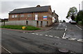
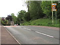
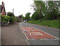
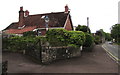
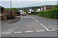
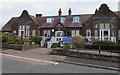
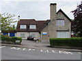
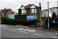
Photos of GL15 5JF


Area Information
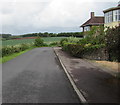
Living in GL15 5JF offers a quiet, residential experience in a small cluster of homes. With a population of 1,571 and a density of 83 people per square kilometre, the area feels intimate, avoiding the congestion of larger towns. This postcode is defined by its proximity to Lydney and surrounding villages, blending rural charm with accessible amenities. The community here is predominantly middle-aged, with a median age of 47, and many residents are homeowners, reflecting a stable, long-term presence. Daily life is shaped by nearby shops, transport links, and natural surroundings. While the area lacks major urban hubs, its small size ensures a close-knit feel, where familiar faces and local routines are common. For those seeking a peaceful yet connected lifestyle, GL15 5JF balances seclusion with practicality, offering homes in a setting that prioritises comfort over convenience.
- Area Type
- Postcode
- Area Size
- Not available
- Population
- 1571
- Population Density
- 83 people/km²
The property market in GL15 5JF is characterised by high home ownership, with 78% of residents owning their homes. This suggests a stable, owner-occupied market rather than a rental-focused one. The accommodation type is predominantly houses, which aligns with the area’s low density and suburban feel. For buyers, this means a limited stock of properties, as the area is small and residential in nature. The focus on houses rather than flats may appeal to those seeking larger living spaces or gardens. However, the small size of the postcode means the housing stock is not extensive, and buyers may need to consider nearby areas for more options. The high ownership rate also implies that properties are likely to be in good condition, with long-term residents maintaining their homes. This can be advantageous for buyers seeking reliability and lower turnover in the market.
House Prices in GL15 5JF
No properties found in this postcode.
Energy Efficiency in GL15 5JF
The lifestyle in GL15 5JF is shaped by its proximity to retail, leisure, and transport hubs. Residents have access to multiple supermarkets, including Tesco Lydney, Morrisons Daily, and Lidl Lydney, ensuring shopping trips are convenient. The area’s metro stops, such as Lydney Town and Norchard, provide connections to nearby towns, while Lydney Railway Station offers links to further destinations. For leisure, the nearby Lydney Harbour and Sharpness Old Docks suggest opportunities for water-based activities or scenic walks. The presence of Dean Forest Railway adds a historical element to the area’s transport network. While the data does not specify parks or recreational spaces, the low population density implies some green space may be available. The mix of retail, transport, and historical sites creates a lifestyle that balances practicality with local character, appealing to those who value accessibility without urban overcrowding.
Amenities
Schools
The nearest schools to GL15 5JF include Aylburton Church of England Primary School, listed twice in the data. Both entries indicate a primary school, though no Ofsted ratings are provided. This suggests a focus on early education for local families, with the primary school serving the immediate community. The duplication of the school’s name may reflect administrative details rather than multiple institutions. For families with young children, the availability of a primary school within reach is a practical benefit, reducing the need for long commutes. However, the absence of secondary schools or other educational institutions in the data means that students may need to travel further for higher education. The school’s presence supports the area’s appeal to families, though buyers should consider additional schooling options beyond primary level.
| Rank | School | Type | Entry gender | Ages |
|---|
Explore more schools in this area
Go to Schools tabDemographics
The population of GL15 5JF is 1,571, with a median age of 47, indicating a mature community. The most common age range is 30–64 years, suggesting a mix of established families and professionals. Home ownership is high at 78%, with the majority of properties being houses rather than flats. This reflects a demographic that values stability and long-term investment in property. The predominant ethnic group is White, though specific diversity data is not provided. The age profile implies a community with strong family ties and lower turnover, which can contribute to a cohesive neighbourhood. The low population density also means fewer residents per square kilometre, offering more space and less pressure on shared resources. For buyers, this suggests a market where homes are likely to be well-maintained and occupied by residents with a vested interest in the area’s upkeep.
Household Size
Accommodation Type
Tenure
Ethnic Group
Religion
Household Composition
Age
Household Deprivation
NS-SEC
Explore more demographic insights in this area
Go to Demographics tabPlanning
Planning Constraints
- Flood RiskPremium
- Ramsar Wetland SitesPremium
- Area of Outstanding Natural BeautyPremium
- Protected Nature ReservePremium
- Protected WoodlandPremium