Area Overview for GL15 5DD
Photos of GL15 5DD
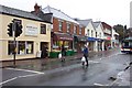


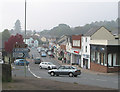
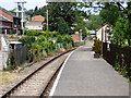
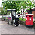
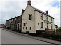
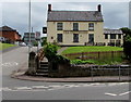
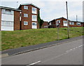
98 photos from this area
Area Information
Key information about the GL15 5DD including its size, population, and administrative classification.
- Area Type
- Postcode
- Area Size
- 8441 m²
- Population
- 1418
- Population Density
- 296 people/km²
House Prices in GL15 5DD
15
Properties
£109,600
Average Sold Price
£32,000
Lowest Price
£240,000
Highest Price
Showing 15 properties
| Address | Type | Beds | Baths | Last Sale Price | Last Sale Date | |
|---|---|---|---|---|---|---|
| 57 High Street, Lydney, GL15 5DD | Semi-detached | 4 | - | £240,000 | Aug 2024 | |
| 59 High Street, Lydney, GL15 5DD | Semi-detached | 3 | 5 | £160,000 | Jul 2007 | |
| 49A High Street, Lydney, GL15 5DD | undefined | - | - | £58,000 | Mar 2004 | |
| 61 High Street, Lydney, GL15 5DD | Semi-detached | - | - | £58,000 | Nov 2000 | |
| 37 High Street, Lydney, GL15 5DD | Terraced | - | - | £32,000 | Dec 1996 | |
| 35A High Street, Lydney, GL15 5DD | Flat | 3 | - | - | - | |
| First Floor Flat, 57 High Street, Lydney, GL15 5DD | Flat | - | - | - | - | |
| Ground Floor Flat, 57 High Street, Lydney, GL15 5DD | Flat | - | - | - | - | |
| Ground Floor Left, 45 High Street, Lydney, GL15 5DD | Flat | - | - | - | - | |
| Flat 1, Raglan House, High Street, Lydney, GL15 5DD | Flat | - | - | - | - |
Page 1 of 2
Energy Efficiency in GL15 5DD
Amenities
Schools
| Rank | School | Type | Entry gender | Ages |
|---|
Explore more schools in this area
Go to Schools tabDemographics
Household Size
One person
most common
Accommodation Type
Houses
most common
Tenure
65
majority
Ethnic Group
White
most common
Religion
N/A
most common
Household Composition
N/A
most common
Age
47
median
Adults (30-64 years)
most common
Household Deprivation
N/A
with no deprivation
NS-SEC
27
in Lower managerial occupations
Explore more demographic insights in this area
Go to Demographics tabPlanning
Planning Constraints
- Flood RiskPremium
- Ramsar Wetland SitesPremium
- Area of Outstanding Natural BeautyPremium
- Protected Nature ReservePremium
- Protected WoodlandPremium