Area Overview for GL15 4TN
Photos of GL15 4TN

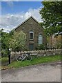

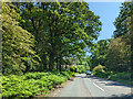
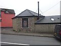
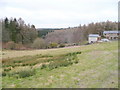
33 photos from this area
Area Information
Key information about the GL15 4TN including its size, population, and administrative classification.
- Area Type
- Postcode
- Area Size
- 1.3 hectares
- Population
- 1869
- Population Density
- 84 people/km²
House Prices in GL15 4TN
17
Properties
£263,583
Average Sold Price
£70,000
Lowest Price
£468,500
Highest Price
Showing 17 properties
| Address | Type | Beds | Baths | Last Sale Price | Last Sale Date | |
|---|---|---|---|---|---|---|
| Silverdeane, Lower Road, Yorkley, GL15 4TN | Detached | 4 | 7 | £468,500 | Aug 2024 | |
| Tree Tops, Lower Road, Yorkley, GL15 4TN | Bungalow | 3 | 1 | £345,000 | Feb 2024 | |
| Sycamore House, Lower Road, Yorkley, GL15 4TN | Semi-detached | 3 | 3 | £350,000 | Jul 2022 | |
| Copse Edge, Lower Road, Yorkley, GL15 4TN | Detached | 3 | 2 | £405,000 | Oct 2021 | |
| Ivy Cottage, Lower Road, Yorkley, GL15 4TN | Semi-detached | 2 | 1 | £207,000 | Aug 2019 | |
| Hill Grove Cottage, Lower Road, Yorkley, GL15 4TN | Semi-detached | 2 | 1 | £158,000 | Jun 2018 | |
| Hollytree Cottage, Lower Road, Yorkley, GL15 4TN | Semi-detached | 3 | 1 | £235,000 | Mar 2016 | |
| Sumac, Lower Road, Yorkley, GL15 4TN | house | 3 | - | £70,000 | Sep 2010 | |
| Four Seasons, Lower Road, Yorkley, GL15 4TN | Bungalow | 3 | - | £170,000 | Jun 2010 | |
| La Concha, Lower Road, Yorkley, GL15 4TN | Detached | - | - | £220,000 | Dec 2009 |
Page 1 of 2
Energy Efficiency in GL15 4TN
Amenities
Schools
| Rank | School | Type | Entry gender | Ages |
|---|
Explore more schools in this area
Go to Schools tabDemographics
Household Size
Two person
most common
Accommodation Type
Houses
most common
Tenure
87
majority
Ethnic Group
White
most common
Religion
N/A
most common
Household Composition
N/A
most common
Age
47
median
Adults (30-64 years)
most common
Household Deprivation
N/A
with no deprivation
NS-SEC
35
in Lower managerial occupations
Explore more demographic insights in this area
Go to Demographics tabPlanning
Planning Constraints
- Flood RiskPremium
- Ramsar Wetland SitesPremium
- Area of Outstanding Natural BeautyPremium
- Protected Nature ReservePremium
- Protected WoodlandPremium