Area Overview for GL15 4RS
Photos of GL15 4RS

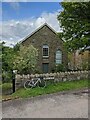
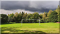
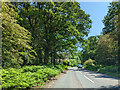
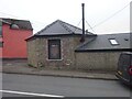
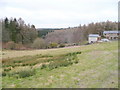
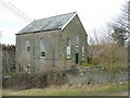
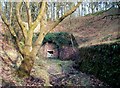
33 photos from this area
Area Information
Key information about the GL15 4RS including its size, population, and administrative classification.
- Area Type
- Postcode
- Area Size
- 10.7 hectares
- Population
- 1665
- Population Density
- 383 people/km²
House Prices in GL15 4RS
22
Properties
£209,400
Average Sold Price
£57,500
Lowest Price
£385,000
Highest Price
Showing 22 properties
| Address | Type | Beds | Baths | Last Sale Price | Last Sale Date | |
|---|---|---|---|---|---|---|
| Bailey House, Bailey Hill, Yorkley, GL15 4RS | house | 3 | - | £225,000 | May 2021 | |
| Cockshoot Lodge, Bailey Hill, Yorkley, GL15 4RS | Detached | 3 | 1 | £352,500 | Nov 2020 | |
| 1, The Larches, Bailey Hill, Yorkley, GL15 4RS | house | 3 | - | £385,000 | Nov 2020 | |
| Bromleigh, Bailey Hill, Yorkley, GL15 4RS | Semi-detached | 2 | - | £145,000 | Dec 2018 | |
| Cope Stone Barn, Bailey Hill, Yorkley, GL15 4RS | Detached | 3 | 2 | £295,000 | Apr 2015 | |
| Hawkwind, Bailey Hill, Yorkley, GL15 4RS | Semi-detached | 3 | - | £165,000 | Dec 2013 | |
| Southdene, Bailey Hill, Yorkley, GL15 4RS | house | 3 | - | £265,000 | Apr 2012 | |
| Chems Patch, Bailey Hill, Yorkley, GL15 4RS | house | - | - | £172,500 | Jun 2011 | |
| Tesstress, Bailey Hill, Yorkley, GL15 4RS | house | - | - | £205,000 | Nov 2010 | |
| 3, The Larches, Bailey Hill, Yorkley, GL15 4RS | Detached | 4 | - | £295,000 | Oct 2010 |
Page 1 of 3
Energy Efficiency in GL15 4RS
Amenities
Schools
| Rank | School | Type | Entry gender | Ages |
|---|
Explore more schools in this area
Go to Schools tabDemographics
Household Size
Two person
most common
Accommodation Type
Houses
most common
Tenure
76
majority
Ethnic Group
White
most common
Religion
N/A
most common
Household Composition
N/A
most common
Age
47
median
Adults (30-64 years)
most common
Household Deprivation
N/A
with no deprivation
NS-SEC
30
in Lower managerial occupations
Explore more demographic insights in this area
Go to Demographics tabPlanning
Planning Constraints
- Flood RiskPremium
- Ramsar Wetland SitesPremium
- Area of Outstanding Natural BeautyPremium
- Protected Nature ReservePremium
- Protected WoodlandPremium