Area Overview for GL14 3NN
Photos of GL14 3NN
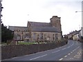
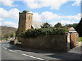
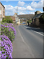
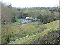
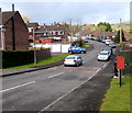
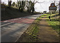
81 photos from this area
Area Information
Key information about the GL14 3NN including its size, population, and administrative classification.
- Area Type
- Postcode
- Area Size
- 5.1 hectares
- Population
- 2039
- Population Density
- 110 people/km²
House Prices in GL14 3NN
33
Properties
£187,495
Average Sold Price
£80,000
Lowest Price
£395,000
Highest Price
Showing 33 properties
| Address | Type | Beds | Baths | Last Sale Price | Last Sale Date | |
|---|---|---|---|---|---|---|
| 10 Silver Street, Littledean, GL14 3NN | Terraced | 3 | 1 | £224,000 | Nov 2024 | |
| 7 Silver Street, Littledean, GL14 3NN | Terraced | 2 | 1 | £191,000 | Aug 2024 | |
| Old Lion Cottage, 12 Silver Street, Littledean, GL14 3NN | Cottage | 3 | 1 | £350,000 | Jul 2024 | |
| 15 Silver Street, Littledean, GL14 3NN | house | 4 | 2 | £395,000 | Jun 2023 | |
| 8 Silver Street, Littledean, GL14 3NN | Terraced | 2 | 1 | £162,000 | Mar 2022 | |
| 2 Silver Street, Littledean, GL14 3NN | Terraced | 3 | 1 | £180,000 | Dec 2020 | |
| Greenfields, Silver Street, Littledean, GL14 3NN | Semi-detached | 3 | 2 | £212,000 | Nov 2020 | |
| Greystones, Silver Street, Littledean, GL14 3NN | Detached | 3 | - | £265,000 | Aug 2019 | |
| 1 Silver Street, Littledean, GL14 3NN | Detached | 4 | - | £280,000 | May 2019 | |
| 9 Silver Street, Littledean, GL14 3NN | Terraced | 3 | 1 | £213,000 | Feb 2019 |
Page 1 of 4
Energy Efficiency in GL14 3NN
Amenities
Schools
| Rank | School | Type | Entry gender | Ages |
|---|
Explore more schools in this area
Go to Schools tabDemographics
Household Size
Two person
most common
Accommodation Type
Houses
most common
Tenure
83
majority
Ethnic Group
White
most common
Religion
N/A
most common
Household Composition
N/A
most common
Age
47
median
Adults (30-64 years)
most common
Household Deprivation
N/A
with no deprivation
NS-SEC
32
in Lower managerial occupations
Explore more demographic insights in this area
Go to Demographics tabPlanning
Planning Constraints
- Flood RiskPremium
- Ramsar Wetland SitesPremium
- Area of Outstanding Natural BeautyPremium
- Protected Nature ReservePremium
- Protected WoodlandPremium