Area Overview for GL14 3HX
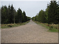
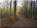
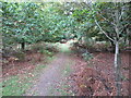
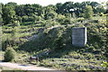
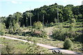
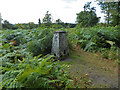
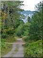
Photos of GL14 3HX


Area Information
Living in GL14 3HX offers a quiet, compact residential experience within a 2.6 km² postcode area. With a population of 1,551, the community is small but functional, centred around a mix of local services and transport links. The area’s character is defined by its low density and focus on single-family homes, reflecting a demographic skewed toward adults aged 30–64. Daily life here balances practicality with accessibility, with nearby retail options and rail connections providing convenience without the bustle of larger towns. The postcode’s size means it is not sprawling, but it is well-served by essential amenities within a short distance. For those seeking a low-key, community-focused environment, GL14 3HX offers a straightforward lifestyle, free from the pressures of high-density living. Its proximity to transport routes and local shops ensures residents can meet daily needs without long commutes. The area’s compact nature also means it is easy to navigate, making it appealing to those who value simplicity in their surroundings.
- Area Type
- Postcode
- Area Size
- 2.6 km²
- Population
- 1551
- Population Density
- 141 people/km²
The property market in GL14 3HX is characterised by a 44% home ownership rate, indicating that nearly half of the area’s housing stock is rented out. This suggests a mixed market, with a significant proportion of properties available for rental, potentially attracting both long-term tenants and first-time buyers. The accommodation type is predominantly houses, which aligns with the area’s low density and residential feel. This contrasts with high-density urban areas, where flats and apartments dominate. For buyers, this means the market is unlikely to be oversaturated with rental properties, but the limited size of the postcode (2.6 km²) may restrict the availability of diverse property options. The focus on single-family homes also implies that the area is more suited to those seeking traditional housing rather than investment in multi-unit properties.
House Prices in GL14 3HX
No properties found in this postcode.
Energy Efficiency in GL14 3HX
The lifestyle in GL14 3HX is shaped by its proximity to specific amenities, including retail stores and transport links. Nearby shops such as Co-op Valley, Lidl Cinderford, and Tesco Cinderford provide access to groceries, household goods, and other daily necessities. These stores are within practical reach, reducing the need for long trips to larger towns. The Dean Forest Railway, with stops at Parkend and other stations, offers a reliable means of travel for commuting or exploring further afield. While the area lacks large-scale leisure facilities, the presence of these amenities ensures residents can meet basic needs without significant inconvenience. The small-scale nature of GL14 3HX means its lifestyle is quiet and focused on local convenience rather than sprawling commercial hubs. This makes it appealing to those who value simplicity and accessibility over extensive entertainment options.
Amenities
Schools
| Rank | School | Type | Entry gender | Ages |
|---|
Explore more schools in this area
Go to Schools tabDemographics
The community in GL14 3HX is predominantly composed of adults aged 30–64, with a median age of 47. This suggests a stable, established population rather than a transient one. Home ownership rates stand at 44%, indicating that nearly half of residents rent their homes, which may reflect a mix of long-term tenants and newer buyers. The area is largely composed of houses, rather than flats or apartments, aligning with its low population density of 141 people per km². The predominant ethnic group is White, though no specific data on diversity or deprivation is provided. The age profile and housing stock suggest a mature, settled community, with fewer young families or students compared to more dynamic urban areas. This demographic structure may influence local services and amenities, which are tailored to the needs of middle-aged residents.
Household Size
Accommodation Type
Tenure
Ethnic Group
Religion
Household Composition
Age
Household Deprivation
NS-SEC
Explore more demographic insights in this area
Go to Demographics tabPlanning
Planning Constraints
- Flood RiskPremium
- Ramsar Wetland SitesPremium
- Area of Outstanding Natural BeautyPremium
- Protected Nature ReservePremium
- Protected WoodlandPremium