Area Overview for GL14 3EN
Photos of GL14 3EN
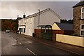
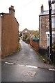
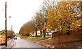

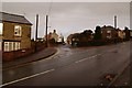
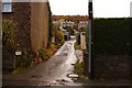
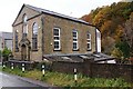
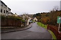
58 photos from this area
Area Information
Key information about the GL14 3EN including its size, population, and administrative classification.
- Area Type
- Postcode
- Area Size
- 4035 m²
- Population
- 1578
- Population Density
- 3168 people/km²
House Prices in GL14 3EN
8
Properties
£121,750
Average Sold Price
£38,500
Lowest Price
£224,000
Highest Price
Showing 8 properties
| Address | Type | Beds | Baths | Last Sale Price | Last Sale Date | |
|---|---|---|---|---|---|---|
| 138 Church Road, Cinderford, GL14 3EN | Semi-detached | 2 | 1 | £182,500 | Aug 2023 | |
| Clowder House, 93A Church Road, Cinderford, GL14 3EN | house | 3 | 1 | £224,000 | Nov 2017 | |
| 95 Church Road, Cinderford, GL14 3EN | Semi-detached | 2 | - | £122,500 | Nov 2015 | |
| 140 Church Road, Cinderford, GL14 3EN | Semi-detached | 2 | 1 | £108,000 | Nov 2014 | |
| 93 Church Road, Cinderford, GL14 3EN | Terraced | 2 | 1 | £55,000 | Jul 2000 | |
| 144 Church Road, Cinderford, GL14 3EN | Semi-detached | - | - | £38,500 | Jan 1996 | |
| 97 Church Road, Cinderford, GL14 3EN | house | - | - | - | - | |
| 142 Church Road, Cinderford, GL14 3EN | Semi-detached | - | - | - | - |
Energy Efficiency in GL14 3EN
Amenities
Schools
| Rank | School | Type | Entry gender | Ages |
|---|
Explore more schools in this area
Go to Schools tabDemographics
Household Size
Two person
most common
Accommodation Type
Houses
most common
Tenure
80
majority
Ethnic Group
White
most common
Religion
N/A
most common
Household Composition
N/A
most common
Age
47
median
Adults (30-64 years)
most common
Household Deprivation
N/A
with no deprivation
NS-SEC
24
in Lower managerial occupations
Explore more demographic insights in this area
Go to Demographics tabPlanning
Planning Constraints
- Flood RiskPremium
- Ramsar Wetland SitesPremium
- Area of Outstanding Natural BeautyPremium
- Protected Nature ReservePremium
- Protected WoodlandPremium