Area Overview for GL14 2YE
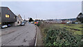
Photos of GL14 2YE


Area Information
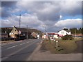
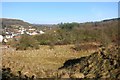
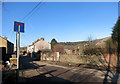
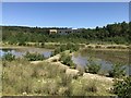
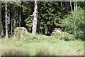
Living in GL14 2YE means inhabiting a compact, residential cluster in England’s countryside, where 2,091 people reside across 4.1 hectares. The area’s small size fosters a tight-knit community, with homes predominantly houses rather than flats. The median age of 47 suggests a population skewed toward adults in their 30s to 60s, many of whom own their properties—62% of households are owner-occupied. Daily life here is shaped by proximity to local amenities, including shops and a historic railway line. While the area lacks large urban infrastructure, its low population density and residential focus create a quiet, stable environment. However, buyers should note the area’s critical flood risk, a factor that may influence property choices. For those prioritising convenience over city sprawl, GL14 2YE offers a self-contained lifestyle with access to nearby towns for broader services. The balance between seclusion and practicality defines this postcode’s appeal.
- Area Type
- Postcode
- Area Size
- 4.1 hectares
- Population
- 2091
- Population Density
- 621 people/km²
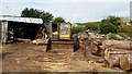
GL14 2YE is a predominantly owner-occupied area, with 62% of homes owned by their residents. The housing stock consists almost entirely of houses, which suggests a focus on family homes or single-dwelling properties. Given the small area size of 4.1 hectares, the property market is limited in scale, likely offering fewer options compared to larger towns. The high home ownership rate indicates a stable market with less turnover, potentially making it easier for buyers to find established properties. However, the area’s small footprint means that buyers may need to look beyond GL14 2YE itself for more extensive housing options. The lack of flats or apartments further narrows the market, appealing more to those seeking traditional homes rather than modern or rental-focused developments.
House Prices in GL14 2YE
Showing 3 properties
| Address | Type | Beds | Baths | Last Sale Price | Last Sale Date | |
|---|---|---|---|---|---|---|
| Unit 4, Excavator House, Broadmoor Road, Cinderford, GL14 2YE | Industrial | - | - | - | - | |
| Bridge Bungalow, Broadmoor Road, Cinderford, GL14 2YE | Detached | - | - | - | - | |
| Unit 2, Excavator House, Broadmoor Road, Cinderford, GL14 2YE | Industrial | - | - | - | - |
Energy Efficiency in GL14 2YE
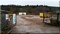
Daily life in GL14 2YE is shaped by its proximity to basic retail and leisure options. The area’s nearest amenities include Co-op Valley, Lidl Cinderford, and Tesco Cinderford, providing essential shopping and food services. These stores cater to everyday needs, though the selection is limited compared to larger towns. The Dean Forest Railway adds a unique element to the area’s character, offering a nostalgic mode of transport and scenic routes. Beyond retail, the area’s small size means that parks or recreational facilities are not explicitly listed, suggesting that residents may need to travel to nearby towns for more extensive leisure options. The combination of practical retail access and historical transport links creates a lifestyle that balances convenience with a rural charm, ideal for those seeking simplicity over urban sprawl.
Amenities
Schools
The nearest school to GL14 2YE is Steam Mills Primary School, a primary institution with a good Ofsted rating. This school serves the local community, providing education for younger children within the area. The absence of secondary schools in the immediate vicinity means families may need to commute to nearby towns for higher education. However, the presence of a well-rated primary school is a significant draw for families prioritising quality early education. The single school type in the area suggests a focus on foundational learning, though parents seeking a full range of educational options may need to consider additional commuting. For those valuing a strong primary education, Steam Mills Primary School offers a reliable option within walking or short driving distance.
| Rank | School | Type | Entry gender | Ages |
|---|
Explore more schools in this area
Go to Schools tabDemographics
The population of GL14 2YE is 2,091, with a population density of 621 people per square kilometre. The median age of 47 indicates a mature demographic, with the majority of residents falling within the 30–64 age range. This suggests a community of established professionals and families, rather than a transient population. Home ownership is high at 62%, reflecting a preference for long-term residency. The area is composed almost entirely of houses, with no flats or apartments recorded. The predominant ethnic group is White, though no data is provided on other ethnicities. At 621 people per square kilometre, the density is moderate, allowing for a mix of private spaces and shared community resources. This profile aligns with a suburban or semi-rural setting, where stability and ownership are prioritised over rental flexibility.
Household Size
Accommodation Type
Tenure
Ethnic Group
Religion
Household Composition
Age
Household Deprivation
NS-SEC
Explore more demographic insights in this area
Go to Demographics tabPlanning
Planning Constraints
- Flood RiskPremium
- Ramsar Wetland SitesPremium
- Area of Outstanding Natural BeautyPremium
- Protected Nature ReservePremium
- Protected WoodlandPremium