Area Overview for GL14 2TE
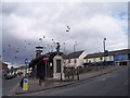
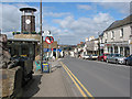
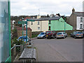
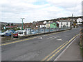
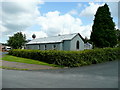
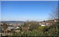
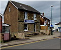
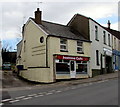
Photos of GL14 2TE
Area Information
Living in GL14 2TE means inhabiting a small, tightly packed residential cluster in England’s Gloucestershire region. The area spans 19 hectares, housing 2,091 people at a density of 621 per square kilometre. This compact postcode is defined by its mature community, with a median age of 47 and a majority of residents aged 30–64. Daily life here is characterised by proximity to essential amenities, including Lidl Cinderford, Co-op Valley, and Tesco Cinderford, which cater to practical needs. The area’s modest size means it is not a sprawling suburb but a cohesive neighbourhood where local services and social networks are likely to be well-established. While it lacks the vibrancy of larger urban centres, GL14 2TE offers a quiet, stable environment. The nearby Dean Forest Railway and Parkend provide transport links, though the area is not a hub for major infrastructure. For those seeking a low-key, community-focused lifestyle, GL14 2TE’s blend of practicality and tranquillity could be appealing.
- Area Type
- Postcode
- Area Size
- 19.0 hectares
- Population
- 2091
- Population Density
- 621 people/km²
The property market in GL14 2TE is dominated by owner-occupied homes, with 62% of residents living in properties they own. The accommodation type is predominantly houses, which suggests a focus on family homes or single-occupancy residences rather than flats or apartments. Given the area’s small size and high population density, the housing stock is likely limited, meaning buyers may need to consider nearby postcode areas for more options. The high home ownership rate indicates a stable market with long-term residents, which can be a positive sign for property retention. However, the lack of rental data means it is unclear whether the area has a significant rental sector. For buyers, the mix of houses may appeal to those seeking traditional, spacious properties, though the limited size of GL14 2TE itself may restrict availability.
House Prices in GL14 2TE
Showing 44 properties
| Address | Type | Beds | Baths | Last Sale Price | Last Sale Date | |
|---|---|---|---|---|---|---|
| 9 Springfield Drive, Cinderford, GL14 2TE | Semi-detached | 3 | 1 | £237,000 | Apr 2025 | |
| 41 Springfield Drive, Cinderford, GL14 2TE | Bungalow | 4 | 3 | £397,500 | May 2024 | |
| 2 Springfield Drive, Cinderford, GL14 2TE | Bungalow | 3 | 1 | £105,000 | Dec 2023 | |
| 49 Springfield Drive, Cinderford, GL14 2TE | Semi-detached | 3 | 1 | £297,500 | Aug 2023 | |
| 12 Springfield Drive, Cinderford, GL14 2TE | Bungalow | 2 | - | £270,000 | Dec 2022 | |
| Kalma, 25 Springfield Drive, Cinderford, GL14 2TE | Bungalow | 3 | 1 | £365,000 | Jul 2022 | |
| 7 Springfield Drive, Cinderford, GL14 2TE | Semi-detached | 3 | 1 | £285,000 | Jan 2021 | |
| 15 Springfield Drive, Cinderford, GL14 2TE | Bungalow | 2 | 1 | £232,500 | Nov 2019 | |
| 1 Springfield Drive, Cinderford, GL14 2TE | Bungalow | 3 | 1 | £355,500 | Jun 2019 | |
| 16 Springfield Drive, Cinderford, GL14 2TE | Bungalow | 2 | - | £235,000 | Dec 2018 |
Energy Efficiency in GL14 2TE
The lifestyle in GL14 2TE is shaped by its proximity to essential retail and transport options. Nearby shops include Lidl Cinderford, Co-op Valley, and Tesco Cinderford, providing access to groceries, household items, and other daily necessities. These stores are within practical reach, supporting a self-sufficient local economy. The Dean Forest Railway and Parkend offer transport links, though the area’s small size means leisure and recreational facilities are limited to what is immediately accessible. The absence of detailed information on parks or cultural amenities suggests that residents may need to travel to larger towns for broader leisure opportunities. The combination of retail convenience and modest transport options creates a functional, if unadorned, lifestyle suited to those prioritising practicality over extensive amenities.
Amenities
Schools
The nearest school to GL14 2TE is Steam Mills Primary School, which has an Ofsted rating of ‘good’. This primary school serves the local community, offering education for younger children. The absence of secondary schools in the immediate vicinity means families with older children may need to look further afield for secondary education. The presence of a well-rated primary school is a key consideration for parents, as it provides a foundation for early learning. However, the data does not specify the distance to the nearest secondary school or its quality, which could be a practical concern for households with children of varying ages. Families relying on this single school may need to factor in commuting times or alternative schooling options beyond the immediate area.
| Rank | School | Type | Entry gender | Ages |
|---|
Explore more schools in this area
Go to Schools tabDemographics
The population of GL14 2TE is predominantly adults aged 30–64, reflecting a mature demographic with a median age of 47. Home ownership is high at 62%, indicating a stable community where most residents live in their own homes rather than renting. The accommodation type is primarily houses, suggesting a mix of family homes and single-occupancy properties. The predominant ethnic group is White, with no specific data on other demographics provided. The population density of 621 people per square kilometre is notably high for the area’s small size, implying a compact, closely knit community. This density may influence local amenities and social dynamics, though it does not necessarily correlate with deprivation levels. The absence of detailed diversity statistics means the area’s cultural composition remains largely undefined in the data.
Household Size
Accommodation Type
Tenure
Ethnic Group
Religion
Household Composition
Age
Household Deprivation
NS-SEC
Explore more demographic insights in this area
Go to Demographics tabPlanning
Planning Constraints
- Flood RiskPremium
- Ramsar Wetland SitesPremium
- Area of Outstanding Natural BeautyPremium
- Protected Nature ReservePremium
- Protected WoodlandPremium