Area Overview for GL14 2PN
Photos of GL14 2PN


Area Information
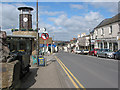
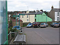
Living in GL14 2PN offers a quiet, residential experience within a small cluster of homes. With a population of 2,060, the area feels close-knit, though its compact size means it is best suited for those prioritising proximity to local amenities over expansive space. The postcode covers a mix of housing stock, predominantly family homes, reflecting a community rooted in stability. Residents here are likely to value convenience over urban vibrancy, with nearby retail options and transport links providing essential connectivity. The area’s low flood risk and absence of protected natural sites suggest a practical, low-maintenance environment. However, its modest size means it is not ideal for those seeking sprawling landscapes or extensive public services. For buyers looking for a straightforward, no-frills lifestyle with access to basic needs, GL14 2PN offers a straightforward proposition.
- Area Type
- Postcode
- Area Size
- Not available
- Population
- 2060
- Population Density
- 4798 people/km²
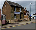
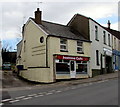
GL14 2PN is a predominantly owner-occupied area, with 73% of homes owned by residents rather than rented. The housing stock is largely composed of houses, which is uncommon in smaller postcodes where flats or apartments might dominate. This suggests a market geared towards families or individuals seeking private, standalone properties. The small size of the area means the housing stock is limited, which could make it challenging for buyers seeking a wide selection. However, the high home ownership rate indicates a steady demand for properties here, potentially offering stability for those entering the market. Buyers should consider the area’s constraints when evaluating long-term value or investment potential.
House Prices in GL14 2PN
Showing 3 properties
| Address | Type | Beds | Baths | Last Sale Price | Last Sale Date | |
|---|---|---|---|---|---|---|
| 1, Heywood Mews, Heywood Road, Cinderford, GL14 2PN | Flat | - | - | - | - | |
| 2, Heywood Mews, Heywood Road, Cinderford, GL14 2PN | Flat | - | - | - | - | |
| 3, Heywood Mews, Heywood Road, Cinderford, GL14 2PN | Flat | - | - | - | - |
Energy Efficiency in GL14 2PN
Residents of GL14 2PN have access to nearby retail options, including Tesco Cinderford, Lidl Cinderford, and Co-op Valley, ensuring everyday shopping needs are met. The Dean Forest Railway adds a touch of historical charm and provides a leisure option for rail enthusiasts. While the area lacks large parks or entertainment hubs, the proximity to these amenities suggests a lifestyle focused on practicality and local convenience. The mix of retail and transport options supports a functional daily life, though those seeking extensive leisure facilities may need to look beyond the immediate postcode.
Amenities
Schools
Residents of GL14 2PN have access to three schools within practical reach. St Anthony’s Convent School is an independent institution, offering a fee-paying alternative for families. Oakdene School is a special school, providing tailored education for students with specific needs. St Anthony’s School is an academy, suggesting a state-funded but independently managed approach to education. The mix of school types offers families a range of options, from specialist provision to traditional independent education. However, the absence of data on Ofsted ratings means potential buyers should investigate further to assess quality.
| Rank | School | Type | Entry gender | Ages |
|---|
Explore more schools in this area
Go to Schools tabDemographics
The population of GL14 2PN skews towards adults aged 30–64, with a median age of 47. This suggests a mature, established community where many residents are likely to be settled in long-term housing. Home ownership is high at 73%, indicating a strong preference for property as an asset. The area is composed mainly of houses, rather than flats or apartments, which aligns with the demographic profile of older, family-oriented households. The predominant ethnic group is White, reflecting a homogenous community. While no specific deprivation data is provided, the high home ownership rate and absence of planning constraints suggest a stable, low-risk environment for residents.
Household Size
Accommodation Type
Tenure
Ethnic Group
Religion
Household Composition
Age
Household Deprivation
NS-SEC
Explore more demographic insights in this area
Go to Demographics tabPlanning
Planning Constraints
- Flood RiskPremium
- Ramsar Wetland SitesPremium
- Area of Outstanding Natural BeautyPremium
- Protected Nature ReservePremium
- Protected WoodlandPremium