Area Overview for GL14 2NG
Photos of GL14 2NG
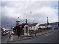
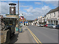
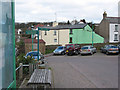
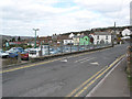
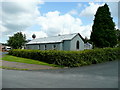
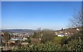
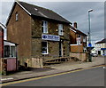
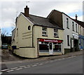
100 photos from this area
Area Information
Key information about the GL14 2NG including its size, population, and administrative classification.
- Area Type
- Postcode
- Area Size
- 2.3 hectares
- Population
- 1551
- Population Density
- 141 people/km²
House Prices in GL14 2NG
59
Properties
£113,284
Average Sold Price
£31,000
Lowest Price
£189,950
Highest Price
Showing 59 properties
| Address | Type | Beds | Baths | Last Sale Price | Last Sale Date | |
|---|---|---|---|---|---|---|
| 24 The Keelings, Cinderford, GL14 2NG | Terraced | 3 | 1 | £189,950 | Jul 2025 | |
| 36 The Keelings, Cinderford, GL14 2NG | Semi-detached | 2 | 1 | £150,000 | Dec 2022 | |
| 12 The Keelings, Cinderford, GL14 2NG | Terraced | 3 | 1 | £170,000 | Sep 2021 | |
| 59 The Keelings, Cinderford, GL14 2NG | Semi-detached | 3 | 1 | £187,500 | Jun 2021 | |
| 3 The Keelings, Cinderford, GL14 2NG | Terraced | 3 | 2 | £140,000 | Oct 2018 | |
| 37 The Keelings, Cinderford, GL14 2NG | Terraced | 2 | - | £130,000 | Oct 2018 | |
| 30 The Keelings, Cinderford, GL14 2NG | house | 2 | - | £142,500 | Sep 2018 | |
| 22 The Keelings, Cinderford, GL14 2NG | Semi-detached | 3 | 1 | £142,000 | Mar 2018 | |
| 51 The Keelings, Cinderford, GL14 2NG | Terraced | 2 | 1 | £102,000 | Aug 2013 | |
| 20 The Keelings, Cinderford, GL14 2NG | house | 3 | 1 | £115,000 | Mar 2010 |
Page 1 of 6
Energy Efficiency in GL14 2NG
Amenities
Schools
| Rank | School | Type | Entry gender | Ages |
|---|
Explore more schools in this area
Go to Schools tabDemographics
Household Size
One person
most common
Accommodation Type
Houses
most common
Tenure
44
majority
Ethnic Group
White
most common
Religion
N/A
most common
Household Composition
N/A
most common
Age
47
median
Adults (30-64 years)
most common
Household Deprivation
N/A
with no deprivation
NS-SEC
17
in Lower managerial occupations
Explore more demographic insights in this area
Go to Demographics tabPlanning
Planning Constraints
- Flood RiskPremium
- Ramsar Wetland SitesPremium
- Area of Outstanding Natural BeautyPremium
- Protected Nature ReservePremium
- Protected WoodlandPremium