Area Overview for GL12 8TN
Photos of GL12 8TN
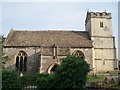
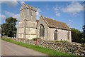
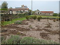
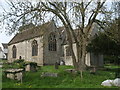
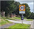
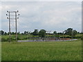
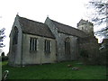
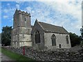
44 photos from this area
Area Information
Key information about the GL12 8TN including its size, population, and administrative classification.
- Area Type
- Postcode
- Area Size
- 5.3 hectares
- Population
- 2346
- Population Density
- 871 people/km²
House Prices in GL12 8TN
28
Properties
£227,302
Average Sold Price
£56,250
Lowest Price
£400,501
Highest Price
Showing 28 properties
| Address | Type | Beds | Baths | Last Sale Price | Last Sale Date | |
|---|---|---|---|---|---|---|
| 110 Manor Lane, Charfield, GL12 8TN | Semi-detached | 4 | 2 | £340,000 | Mar 2024 | |
| 142 Manor Lane, Charfield, GL12 8TN | house | - | - | £400,501 | Apr 2022 | |
| 134 Manor Lane, Charfield, GL12 8TN | Retail | 3 | 1 | £344,995 | Jan 2022 | |
| 53 Manor Lane, Charfield, GL12 8TN | house | - | - | £250,400 | Dec 2020 | |
| 138 Manor Lane, Charfield, GL12 8TN | Semi-detached | 4 | 3 | £395,000 | Jun 2020 | |
| 116 Manor Lane, Charfield, GL12 8TN | Semi-detached | 3 | 1 | £265,000 | Oct 2015 | |
| 130 Manor Lane, Charfield, GL12 8TN | Semi-detached | 3 | 1 | £250,000 | Feb 2015 | |
| 39 Manor Lane, Charfield, GL12 8TN | Semi-detached | 3 | - | £249,000 | Aug 2013 | |
| 120 Manor Lane, Charfield, GL12 8TN | house | - | - | £250,000 | Aug 2011 | |
| 140 Manor Lane, Charfield, GL12 8TN | Semi-detached | - | - | £85,000 | Mar 2008 |
Page 1 of 3
Energy Efficiency in GL12 8TN
Amenities
Schools
| Rank | School | Type | Entry gender | Ages |
|---|
Explore more schools in this area
Go to Schools tabDemographics
Household Size
Family (3-5 people)
most common
Accommodation Type
Houses
most common
Tenure
86
majority
Ethnic Group
White
most common
Religion
N/A
most common
Household Composition
N/A
most common
Age
47
median
Adults (30-64 years)
most common
Household Deprivation
N/A
with no deprivation
NS-SEC
44
in Lower managerial occupations
Explore more demographic insights in this area
Go to Demographics tabPlanning
Planning Constraints
- Flood RiskPremium
- Ramsar Wetland SitesPremium
- Area of Outstanding Natural BeautyPremium
- Protected Nature ReservePremium
- Protected WoodlandPremium