Area Overview for GL12 8BT
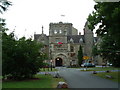
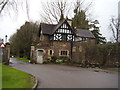
Photos of GL12 8BT


Area Information
Living in GL12 8BT means inhabiting a small, low-density residential cluster in England. The area covers 16.8 hectares and is home to 2,063 people, translating to a population density of 103 people per square kilometre. This makes it a quiet, tightly knit community where homes are predominantly houses, not flats. The area’s compact size means residents can easily access nearby amenities, from retail spots to schools. With a median age of 47 and a majority of residents aged 30–64, GL12 8BT is a stable, family-oriented locale. Daily life here is shaped by proximity to local schools, a nearby railway station, and a modest selection of shops. The low population density and absence of major environmental constraints suggest a peaceful, unobtrusive way of life, ideal for those seeking a balance between rural tranquillity and accessible services.
- Area Type
- Postcode
- Area Size
- 16.8 hectares
- Population
- 2063
- Population Density
- 103 people/km²
The property market in GL12 8BT is dominated by owner-occupied homes, with 72% of residents living in properties they own. This contrasts with rental markets, suggesting a focus on long-term stability rather than transient occupancy. The area’s housing stock is primarily composed of houses, not flats or apartments, which aligns with its low-density, suburban character. Given the small area size of 16.8 hectares and a population of 2,063, the housing stock is limited, making the market potentially competitive for buyers. The proximity to schools, retail, and a railway station adds to the area’s appeal, particularly for families seeking a balance between privacy and accessibility. However, the compact size means buyers must consider the immediate surroundings for additional options, as the area itself offers a finite range of properties.
House Prices in GL12 8BT
Showing 2 properties
| Address | Type | Beds | Baths | Last Sale Price | Last Sale Date | |
|---|---|---|---|---|---|---|
| Time For Teeth Limited, Dentist, Hm Prison Leyhill, Tortworth Road, Tortworth, GL12 8BT | commercial | - | - | - | - | |
| Hm Prison Service The Chief Estates Surveyor, Hm Prison Leyhill, Tortworth Road, Tortworth, GL12 8BT | commercial | - | - | - | - |
Energy Efficiency in GL12 8BT
The lifestyle in GL12 8BT is shaped by its proximity to retail and transport hubs. Five retail venues, including Spar Avon, M&S Michaelwood North BP, and Waitrose, offer shopping convenience within practical reach. The Yate Railway Station provides access to broader networks, making commuting or travel manageable. While the area lacks explicit references to parks or leisure facilities, the presence of multiple schools and retail spots suggests a focus on family-oriented amenities. The compact size means residents can access essentials without long journeys, though the absence of detailed leisure data implies a quieter, less commercialised environment. The mix of retail and transport options supports a balanced lifestyle, blending practicality with the area’s subdued, residential appeal.
Amenities
Schools
Residents of GL12 8BT have access to a range of primary schools, including Tortworth VC Primary School and Tortworth Primary School, both of which serve the local community. St Andrew’s Church of England Primary School in Cromhall, rated satisfactory by Ofsted, offers a state-funded alternative with a religious affiliation. For independent education, Mulberry Tree Steiner School provides an alternative curriculum. This mix of state and independent schools allows families to choose between traditional public education or specialised, fee-paying options. The presence of multiple primary schools within reach suggests a strong focus on family needs, with options for different educational philosophies. The lack of secondary schools in the data means parents may need to look further afield, but the proximity to primary education supports a stable, child-friendly environment.
| Rank | School | Type | Entry gender | Ages |
|---|
Explore more schools in this area
Go to Schools tabDemographics
The community in GL12 8BT is predominantly composed of adults aged 30–64, with a median age of 47. This suggests a mature, established population, likely with long-term ties to the area. Home ownership is high, at 72%, indicating a stable housing market and a focus on long-term residency. The majority of residents identify as White, and the area is characterised by a mix of family homes. The absence of specific deprivation data means no direct commentary on economic challenges, but the high home ownership rate and age profile imply a relatively secure, middle-income demographic. With no mention of diversity metrics, the community appears homogenous in terms of ethnicity. The low population density and house-dominated housing stock further reinforce a suburban, family-centric lifestyle.
Household Size
Accommodation Type
Tenure
Ethnic Group
Religion
Household Composition
Age
Household Deprivation
NS-SEC
Explore more demographic insights in this area
Go to Demographics tabPlanning
Planning Constraints
- Flood RiskPremium
- Ramsar Wetland SitesPremium
- Area of Outstanding Natural BeautyPremium
- Protected Nature ReservePremium
- Protected WoodlandPremium