Area Overview for GL12 7QT
Photos of GL12 7QT
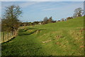

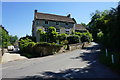
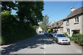

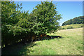

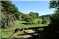
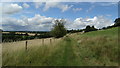
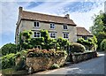

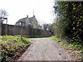
18 photos from this area
Area Information
Key information about the GL12 7QT including its size, population, and administrative classification.
- Area Type
- Postcode
- Area Size
- 3.2 km²
- Population
- 2221
- Population Density
- 84 people/km²
House Prices in GL12 7QT
47
Properties
£672,222
Average Sold Price
£170,000
Lowest Price
£1,865,000
Highest Price
Showing 47 properties
| Address | Type | Beds | Baths | Last Sale Price | Last Sale Date | |
|---|---|---|---|---|---|---|
| Winner Hill Farm, 51488 Alderley To Newmills Farm, Alderley, GL12 7QT | house | 5 | 2 | £800,000 | Feb 2025 | |
| Rose Hill Farm, The Old Rectory To St Kenelms Church, Alderley, GL12 7QT | Bungalow | - | - | £285,000 | Jun 2021 | |
| The Summer House, The Old Rectory To The Furlongs, Alderley, GL12 7QT | Bungalow | 2 | 1 | £975,000 | Mar 2021 | |
| The Old Farmhouse, The Old Rectory To The Furlongs, Alderley, GL12 7QT | house | - | - | £1,865,000 | Mar 2017 | |
| The Old Post Office, 51464 Gate House To St Kenelms Church, Alderley, GL12 7QT | house | - | - | £750,000 | Aug 2014 | |
| Yew Tree Cottage, The Old Rectory To The Furlongs, Alderley, GL12 7QT | Semi-detached | - | - | £355,000 | Aug 2009 | |
| Old Farm, 51488 Alderley To Newmills Farm, Alderley, GL12 7QT | house | 6 | - | £625,000 | Dec 2008 | |
| Alderley Farm, The Old Rectory To The Furlongs, Alderley, GL12 7QT | Detached | 4 | 4 | £225,000 | Aug 2001 | |
| School Cottage, The Old Rectory To The Furlongs, Alderley, GL12 7QT | Detached | - | - | £170,000 | Jun 1996 | |
| Alderley House, The Old Rectory To St Kenelms Church, Alderley, GL12 7QT | Detached | 5 | 2 | - | - |
Page 1 of 5
Energy Efficiency in GL12 7QT
Amenities
Schools
| Rank | School | Type | Entry gender | Ages |
|---|
Explore more schools in this area
Go to Schools tabDemographics
Household Size
Family (3-5 people)
most common
Accommodation Type
Houses
most common
Tenure
81
majority
Ethnic Group
White
most common
Religion
N/A
most common
Household Composition
N/A
most common
Age
47
median
Adults (30-64 years)
most common
Household Deprivation
N/A
with no deprivation
NS-SEC
45
in Lower managerial occupations
Explore more demographic insights in this area
Go to Demographics tabPlanning
Planning Constraints
- Flood RiskPremium
- Ramsar Wetland SitesPremium
- Area of Outstanding Natural BeautyPremium
- Protected Nature ReservePremium
- Protected WoodlandPremium