Area Overview for GL12 7ND
Photos of GL12 7ND
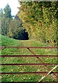
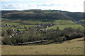

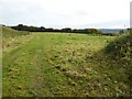
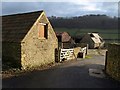


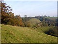


18 photos from this area
Area Information
Key information about the GL12 7ND including its size, population, and administrative classification.
- Area Type
- Postcode
- Area Size
- 6.2 hectares
- Population
- 1541
- Population Density
- 52 people/km²
House Prices in GL12 7ND
27
Properties
£478,630
Average Sold Price
£173,334
Lowest Price
£1,500,000
Highest Price
Showing 27 properties
| Address | Type | Beds | Baths | Last Sale Price | Last Sale Date | |
|---|---|---|---|---|---|---|
| Glentworth, Coombe Village, Coombe, Wotton Under Edge, GL12 7ND | Terraced | 2 | - | £950,000 | May 2025 | |
| Greenhay Farm, Coombe Village, Coombe, Wotton Under Edge, GL12 7ND | Retail | 5 | 2 | £1,500,000 | Jun 2023 | |
| Arden, Coombe Village, Coombe, Wotton Under Edge, GL12 7ND | house | 4 | 2 | £625,000 | Dec 2022 | |
| Loom Cottage, Coombe Village, Coombe, Wotton Under Edge, GL12 7ND | Retail | 3 | 1 | £390,000 | Aug 2022 | |
| Silverhill House, Coombe Village, Coombe, Wotton Under Edge, GL12 7ND | Retail | 4 | 1 | £650,000 | May 2022 | |
| Fawn Cottage, Coombe Village, Coombe, Wotton Under Edge, GL12 7ND | house | - | - | £310,000 | May 2021 | |
| Charnwood, Coombe Village, Coombe, Wotton Under Edge, GL12 7ND | Detached | 5 | 2 | £648,000 | Mar 2020 | |
| Coopers Cottage, Coombe Village, Coombe, Wotton Under Edge, GL12 7ND | Cottage | 2 | 2 | £173,334 | Mar 2019 | |
| Coombe Vale, Coombe Village, Coombe, Wotton Under Edge, GL12 7ND | Detached | 4 | - | £490,000 | Jul 2017 | |
| Shasta Cottage, Coombe Village, Coombe, Wotton Under Edge, GL12 7ND | house | 3 | 2 | £281,000 | Jan 2014 |
Page 1 of 3
Energy Efficiency in GL12 7ND
Amenities
Schools
| Rank | School | Type | Entry gender | Ages |
|---|
Explore more schools in this area
Go to Schools tabDemographics
Household Size
Two person
most common
Accommodation Type
Houses
most common
Tenure
83
majority
Ethnic Group
White
most common
Religion
N/A
most common
Household Composition
N/A
most common
Age
47
median
Adults (30-64 years)
most common
Household Deprivation
N/A
with no deprivation
NS-SEC
49
in Lower managerial occupations
Explore more demographic insights in this area
Go to Demographics tabPlanning
Planning Constraints
- Flood RiskPremium
- Ramsar Wetland SitesPremium
- Area of Outstanding Natural BeautyPremium
- Protected Nature ReservePremium
- Protected WoodlandPremium