Area Overview for GL11 5TE
Photos of GL11 5TE
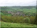
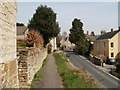


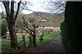
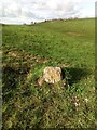
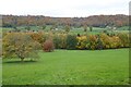
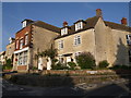
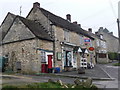
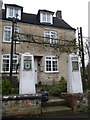
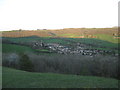
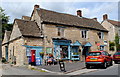
35 photos from this area
Area Information
Key information about the GL11 5TE including its size, population, and administrative classification.
- Area Type
- Postcode
- Area Size
- 1.5 hectares
- Population
- 1333
- Population Density
- 99 people/km²
House Prices in GL11 5TE
19
Properties
£281,246
Average Sold Price
£106,000
Lowest Price
£725,000
Highest Price
Showing 19 properties
| Address | Type | Beds | Baths | Last Sale Price | Last Sale Date | |
|---|---|---|---|---|---|---|
| 4 The Street, Uley, GL11 5TE | house | 2 | 1 | £260,000 | May 2022 | |
| 2 The Street, Uley, GL11 5TE | house | - | - | £330,000 | Feb 2022 | |
| 6 The Street, Uley, GL11 5TE | Semi-detached | 5 | 2 | £411,000 | Nov 2020 | |
| 5 The Street, Uley, GL11 5TE | Cottage | 2 | 1 | £272,000 | Jul 2015 | |
| 17 The Street, Uley, GL11 5TE | Cottage | 2 | 1 | £159,000 | Aug 2013 | |
| 13 The Street, Uley, GL11 5TE | house | 2 | 1 | £106,000 | Aug 2009 | |
| 10 The Street, Uley, GL11 5TE | house | - | - | £367,500 | Aug 2009 | |
| 12 The Street, Uley, GL11 5TE | Terraced | - | - | £725,000 | Feb 2007 | |
| 16 The Street, Uley, GL11 5TE | Semi-detached | - | - | £470,000 | Oct 2006 | |
| 11 The Street, Uley, GL11 5TE | Terraced | 3 | 1 | £182,000 | Apr 2005 |
Page 1 of 2
Energy Efficiency in GL11 5TE
Amenities
Schools
| Rank | School | Type | Entry gender | Ages |
|---|
Explore more schools in this area
Go to Schools tabDemographics
Household Size
Two person
most common
Accommodation Type
Houses
most common
Tenure
74
majority
Ethnic Group
White
most common
Religion
N/A
most common
Household Composition
N/A
most common
Age
47
median
Adults (30-64 years)
most common
Household Deprivation
N/A
with no deprivation
NS-SEC
45
in Lower managerial occupations
Explore more demographic insights in this area
Go to Demographics tabPlanning
Planning Constraints
- Flood RiskPremium
- Ramsar Wetland SitesPremium
- Area of Outstanding Natural BeautyPremium
- Protected Nature ReservePremium
- Protected WoodlandPremium