Area Overview for GL11 5JA
Photos of GL11 5JA


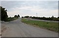
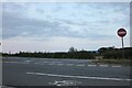

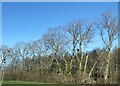


30 photos from this area
Area Information
Key information about the GL11 5JA including its size, population, and administrative classification.
- Area Type
- Postcode
- Area Size
- 61.7 hectares
- Population
- 1179
- Population Density
- 72 people/km²
House Prices in GL11 5JA
7
Properties
£538,333
Average Sold Price
£240,000
Lowest Price
£1,050,000
Highest Price
Showing 7 properties
| Address | Type | Beds | Baths | Last Sale Price | Last Sale Date | |
|---|---|---|---|---|---|---|
| The White House, A 38 Gossington Bridge To Woodend Lane, Cam, GL11 5JA | Cottage | 3 | 2 | £325,000 | Jun 2024 | |
| Sunnyside, A 38 Gossington Bridge To Woodend Lane, Cam, GL11 5JA | Land | 6 | - | £1,050,000 | May 2023 | |
| Hornshill Cottage, A 38 Gossington Bridge To Woodend Lane, Cam, GL11 5JA | house | - | - | £240,000 | Feb 2013 | |
| Caravan At Hornshill Barn, A 38 Gossington Bridge To Woodend Lane, Cam, GL11 5JA | Mobile Home | - | - | - | - | |
| The Bungalow, Sunnyside, A 38 Gossington Bridge To Woodend Lane, Cam, GL11 5JA | undefined | - | - | - | - | |
| Hornshill Farm, A 38 Gossington Bridge To Woodend Lane, Cam, GL11 5JA | house | - | - | - | - | |
| Layby Northbound A38, Layby South Of Gossington Bridge, Cam, GL11 5JA | Restaurant | - | - | - | - |
Energy Efficiency in GL11 5JA
Amenities
Schools
| Rank | School | Type | Entry gender | Ages |
|---|
Explore more schools in this area
Go to Schools tabDemographics
Household Size
Two person
most common
Accommodation Type
Houses
most common
Tenure
82
majority
Ethnic Group
White
most common
Religion
N/A
most common
Household Composition
N/A
most common
Age
47
median
Adults (30-64 years)
most common
Household Deprivation
N/A
with no deprivation
NS-SEC
38
in Lower managerial occupations
Explore more demographic insights in this area
Go to Demographics tabPlanning
Planning Constraints
- Flood RiskPremium
- Ramsar Wetland SitesPremium
- Area of Outstanding Natural BeautyPremium
- Protected Nature ReservePremium
- Protected WoodlandPremium