Area Overview for GL11 4JP
Photos of GL11 4JP
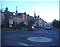
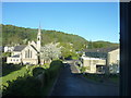
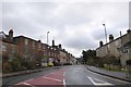
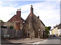
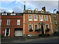
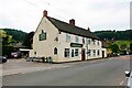
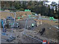
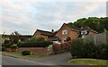
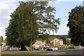
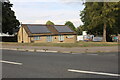
25 photos from this area
Area Information
Key information about the GL11 4JP including its size, population, and administrative classification.
- Area Type
- Postcode
- Area Size
- 3.4 hectares
- Population
- 2442
- Population Density
- 1681 people/km²
House Prices in GL11 4JP
28
Properties
£243,706
Average Sold Price
£85,500
Lowest Price
£541,500
Highest Price
Showing 28 properties
| Address | Type | Beds | Baths | Last Sale Price | Last Sale Date | |
|---|---|---|---|---|---|---|
| 11 Five Acres, Dursley, GL11 4JP | Detached | 4 | 2 | £541,500 | Jun 2025 | |
| 36 Five Acres, Dursley, GL11 4JP | house | - | - | £480,000 | Sep 2022 | |
| 7 Five Acres, Dursley, GL11 4JP | Retail | 3 | 1 | £370,000 | May 2022 | |
| 2 Five Acres, Dursley, GL11 4JP | Semi-detached | 2 | 1 | £198,000 | Aug 2016 | |
| 15 Five Acres, Dursley, GL11 4JP | Detached | 4 | 2 | £262,000 | Dec 2014 | |
| 2A Five Acres, Dursley, GL11 4JP | house | 2 | - | £132,000 | Oct 2012 | |
| 23 Five Acres, Dursley, GL11 4JP | house | - | - | £239,000 | Mar 2010 | |
| 17 Five Acres, Dursley, GL11 4JP | Detached | - | - | £202,000 | Jun 2009 | |
| 30 Five Acres, Dursley, GL11 4JP | Detached | - | - | £284,000 | May 2007 | |
| 9 Five Acres, Dursley, GL11 4JP | Detached | - | - | £331,000 | Mar 2007 |
Page 1 of 3
Energy Efficiency in GL11 4JP
Amenities
Schools
| Rank | School | Type | Entry gender | Ages |
|---|
Explore more schools in this area
Go to Schools tabDemographics
Household Size
Two person
most common
Accommodation Type
Houses
most common
Tenure
81
majority
Ethnic Group
White
most common
Religion
N/A
most common
Household Composition
N/A
most common
Age
47
median
Adults (30-64 years)
most common
Household Deprivation
N/A
with no deprivation
NS-SEC
47
in Lower managerial occupations
Explore more demographic insights in this area
Go to Demographics tabPlanning
Planning Constraints
- Flood RiskPremium
- Ramsar Wetland SitesPremium
- Area of Outstanding Natural BeautyPremium
- Protected Nature ReservePremium
- Protected WoodlandPremium