Area Overview for GL11 4AJ
Photos of GL11 4AJ
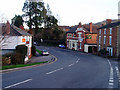
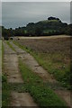

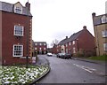
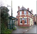
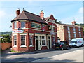
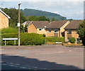
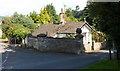
25 photos from this area
Area Information
Key information about the GL11 4AJ including its size, population, and administrative classification.
- Area Type
- Postcode
- Area Size
- 16.2 hectares
- Population
- 1688
- Population Density
- 828 people/km²
House Prices in GL11 4AJ
17
Properties
£258,269
Average Sold Price
£30,000
Lowest Price
£625,000
Highest Price
Showing 17 properties
| Address | Type | Beds | Baths | Last Sale Price | Last Sale Date | |
|---|---|---|---|---|---|---|
| 96 Woodmancote, Dursley, GL11 4AJ | Detached | 3 | 2 | £330,000 | Jul 2020 | |
| Whiteway Foot, Woodmancote, Dursley, GL11 4AJ | Detached | - | - | £625,000 | May 2018 | |
| 78 Woodmancote, Dursley, GL11 4AJ | Cottage | 3 | 1 | £194,000 | Oct 2017 | |
| 106 Woodmancote, Dursley, GL11 4AJ | Detached | 4 | 2 | £465,000 | Aug 2017 | |
| 94 Woodmancote, Dursley, GL11 4AJ | Detached | 4 | - | £355,000 | Sep 2015 | |
| 98 Woodmancote, Dursley, GL11 4AJ | Semi-detached | 3 | 3 | £175,000 | Sep 2014 | |
| 92 Woodmancote, Dursley, GL11 4AJ | Detached | 4 | 2 | £320,000 | Oct 2013 | |
| 90 Woodmancote, Dursley, GL11 4AJ | Semi-detached | 4 | 1 | £215,000 | Aug 2013 | |
| 88 Woodmancote, Dursley, GL11 4AJ | house | - | - | £230,000 | Dec 2010 | |
| 74 Woodmancote, Dursley, GL11 4AJ | house | - | - | £165,000 | Apr 2010 |
Page 1 of 2
Energy Efficiency in GL11 4AJ
Amenities
Schools
| Rank | School | Type | Entry gender | Ages |
|---|
Explore more schools in this area
Go to Schools tabDemographics
Household Size
Two person
most common
Accommodation Type
Houses
most common
Tenure
73
majority
Ethnic Group
White
most common
Religion
N/A
most common
Household Composition
N/A
most common
Age
47
median
Adults (30-64 years)
most common
Household Deprivation
N/A
with no deprivation
NS-SEC
31
in Lower managerial occupations
Explore more demographic insights in this area
Go to Demographics tabPlanning
Planning Constraints
- Flood RiskPremium
- Ramsar Wetland SitesPremium
- Area of Outstanding Natural BeautyPremium
- Protected Nature ReservePremium
- Protected WoodlandPremium