Area Overview for GL10 3TA
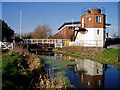
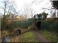
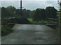
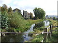
Photos of GL10 3TA

Area Information
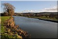
Living in GL10 3TA means occupying a specific residential cluster within the Gloucestershire postcodes. This postcode covers an area of just 3.5 hectares, creating a tightly knit environment where neighbours are likely to know one another. With a population of 1,547, the community feels intimate yet established. It is a defined pocket of housing where daily life revolves around the immediate surroundings and the practicalities of suburban existence. Residents here manage their lives within a small geographical footprint, which often simplifies commuting and access to local services. The area functions as a contained residential zone rather than a sprawling district. For those seeking a specific location within the broader GL10 region, this postcode represents a precise choice. The small size suggests a cohesive neighbourhood where the layout is likely consistent. You are living in a space where the boundaries are clear and the community focus is sharp. This concentration of homes defines the character of the locale for anyone considering homes in GL10 3TA.
- Area Type
- Postcode
- Area Size
- 3.5 hectares
- Population
- 1547
- Population Density
- 1649 people/km²
The property market in GL10 3TA is defined by a significant home ownership presence. Fifty-four per cent of residents own their homes, meaning the area is predominantly owner-occupied rather than a rental estate. Houses form the predominant accommodation type, suggesting terraced or semi-detached family dwellings dominate the stock. This profile typically indicates a stable market where long-term residents stay put. Buyers looking at this postcode should expect a range of private homes rather than large blocks of flats. The lack of flat listings in the primary accommodation data reinforces the house-centric nature of the housing stock. With 54% ownership, there is likely a steady market for second-hand property transactions among owners. The small area size of 3.5 hectares limits the total volume of properties available at any one time. You are entering a market where homes sell based on individual merit and local demand rather than high-volume turnover. This creates a niche environment where each sale is significant to the local community. The housing stock is well-suited to families and established professionals who value space and tenure security.
House Prices in GL10 3TA
No properties found in this postcode.
Energy Efficiency in GL10 3TA
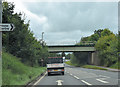
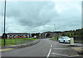
Your daily lifestyle in GL10 3TA benefits from a selection of retail and rail options within practical reach. There are five nearby retail outlets, including Co-op High, Co-op Eastington, and Co-op Kings, providing access to essential groceries and household goods. Rail connectivity is supported by three stations nearby: Stonehouse Railway Station, Stroud Railway Station, and Cam & Dursley Railway Station. These stations offer links to broader transport networks for commuting and leisure travel. The presence of multiple railway stations ensures you have several options for leaving the area when needed. Shopping trips to the Co-ops are a matter of short distances, adding convenience to your routine. The combination of local retail clusters and rail access creates a balanced lifestyle profile. You can run daily errands locally while retaining easy access to wider regions via the train lines. The local amenities ensure that you do not need to travel far for basic needs. Homes in this postcode benefit from this infrastructure mix.
Amenities
Schools
The educational landscape nearest to GL10 3TA includes The Shrubberies School, which is designated as a special school. This institution serves specific educational needs and offers tailored learning environments for pupils. The presence of a special school indicates that the wider locality supports diverse educational requirements. Families with children at this establishment live in close proximity to the postcode area. While this is the only school listed in the immediate vicinity data, it plays a key role in the local education infrastructure. The special school designation means the area caters to students requiring additional support or alternative curriculum focuses. You must consider the travel implications when sourcing schools near GL10 3TA for your children. The educational provision is specialised, offering a specific route for learning within the region. This setup ensures that children with particular needs have access to appropriate schooling without excessive commuting. The school's status is a fixed fact within the administrative data for this zone.
| Rank | School | Type | Entry gender | Ages |
|---|
Explore more schools in this area
Go to Schools tabDemographics
The community in GL10 3TA reflects a mature demographic with a median age of 47. Adults between 30 and 64 years account for the most common age range, indicating a quarter-life or established household population. Home ownership stands at 54%, showing that slightly more than half of the residents own their properties outright. The predominant accommodation type consists of houses, with flats being less common in this specific cluster. The demographic profile points toward families or couples in their middle years who have settled down. White ethnicity is the predominant group within this postcode boundary. This age structure suggests a stable neighbourhood rather than a student or retirement hub. The majority of residents are in their peak earning or working years. You are looking at an area where the residents have likely put down roots for the long term. The mix of home ownership and rental tenants creates a balanced, resident-led community atmosphere. Homes in GL10 3TA are mainly occupied by those in the 30 to 64 age bracket.
Household Size
Accommodation Type
Tenure
Ethnic Group
Religion
Household Composition
Age
Household Deprivation
NS-SEC
Explore more demographic insights in this area
Go to Demographics tabPlanning
Planning Constraints
- Flood RiskPremium
- Ramsar Wetland SitesPremium
- Area of Outstanding Natural BeautyPremium
- Protected Nature ReservePremium
- Protected WoodlandPremium