Area Overview for GL10 3SY
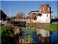
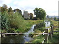
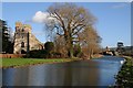
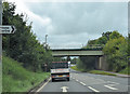
Photos of GL10 3SY


Area Information
Living in GL10 3SY means inhabiting a compact, residential postcode area in England with a population of 1,955 people spread over a densely populated 1.27 square kilometres. This small cluster of homes reflects a tight-knit community, where the majority of residents are adults aged 30–64. The area is characterised by its house-dominated housing stock, with 72% of properties owner-occupied. Daily life here is shaped by proximity to local amenities, including multiple retail outlets and rail stations. The high population density suggests a mix of long-term residents and families, with a focus on practical living. While the area lacks major urban infrastructure, its small size ensures a sense of familiarity. For those seeking a quiet, stable environment with access to nearby towns, GL10 3SY offers a balance of residential comfort and connectivity. The absence of environmental constraints, such as protected woodlands or Areas of Outstanding Natural Beauty, means development is not restricted, though this also means natural landscapes are not a defining feature of the area.
- Area Type
- Postcode
- Area Size
- Not available
- Population
- 1955
- Population Density
- 1546 people/km²
GL10 3SY is primarily an owner-occupied area, with 72% of properties owned by residents rather than rented. The housing stock is dominated by houses, which is unusual for a small postcode area but suggests a focus on family homes. This mix of ownership and property type indicates a market that is more about long-term residency than short-term investment. The compact size of the area means the housing stock is limited, and buyers may need to look beyond GL10 3SY itself to find a wider range of options. The prevalence of houses also implies that the area is less suited to those seeking flats or apartments. For those considering a purchase, the high home ownership rate suggests a stable market, but the small size of the area could mean competition for properties. Buyers should consider the immediate surrounding areas for more choices.
House Prices in GL10 3SY
No properties found in this postcode.
Energy Efficiency in GL10 3SY
The lifestyle in GL10 3SY is shaped by its proximity to essential amenities, including five retail outlets such as Co-op High, Co-op Eastington, and Co-op Kings. These stores provide daily necessities, making the area self-sufficient for basic shopping needs. The three nearby rail stations—Stonehouse, Stroud, and Cam & Dursley—enhance connectivity, allowing residents to access wider services and entertainment in adjacent towns. While the area lacks large parks or leisure facilities, the rail links compensate by offering access to nearby green spaces and cultural attractions. The compact nature of the postcode means amenities are within walking or short driving distance, fostering a convenient, low-maintenance lifestyle. For those who enjoy a mix of local convenience and regional accessibility, GL10 3SY offers a practical balance.
Amenities
Schools
Residents of GL10 3SY have access to two primary schools: Park Junior School, which holds an Ofsted rating of satisfactory, and Stonehouse Park Infant School, rated good. These institutions cater to younger children, with the infant school serving early years and the junior school providing education up to Year 6. The presence of both schools within practical reach means families can access a full primary education without needing to travel far. However, the ratings suggest a mixed quality of education, with one school performing above average and the other meeting basic standards. For families prioritising school quality, the good rating at Stonehouse Park Infant School may be a key factor. The absence of secondary schools in the data means parents should consider proximity to secondary education in nearby towns.
| Rank | School | Type | Entry gender | Ages |
|---|
Explore more schools in this area
Go to Schools tabDemographics
The demographic profile of GL10 3SY is shaped by a median age of 47, with the largest age group being adults aged 30–64. This suggests a mature, established population, likely with strong ties to the local area. Home ownership is high, at 72%, indicating a stable community with long-term residents. The accommodation type is predominantly houses, which aligns with the area’s residential character. The predominant ethnic group is White, reflecting a homogenous population. While no specific data on deprivation is provided, the high home ownership rate and adult age range suggest a community with relatively stable employment and financial security. The absence of detailed diversity metrics means the area’s social composition is not explicitly defined beyond the dominant ethnic group. For buyers, this demographic stability may translate to a predictable housing market and a neighbourhood with minimal turnover.
Household Size
Accommodation Type
Tenure
Ethnic Group
Religion
Household Composition
Age
Household Deprivation
NS-SEC
Explore more demographic insights in this area
Go to Demographics tabPlanning
Planning Constraints
- Flood RiskPremium
- Ramsar Wetland SitesPremium
- Area of Outstanding Natural BeautyPremium
- Protected Nature ReservePremium
- Protected WoodlandPremium