Area Overview for GL1 5JT
Photos of GL1 5JT
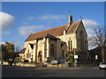
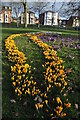
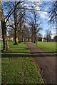
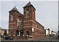

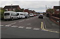
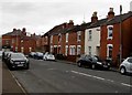
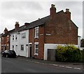
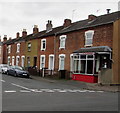

100 photos from this area
Area Information
Key information about the GL1 5JT including its size, population, and administrative classification.
- Area Type
- Postcode
- Area Size
- 4687 m²
- Population
- 1497
- Population Density
- 4845 people/km²
House Prices in GL1 5JT
21
Properties
£127,804
Average Sold Price
£23,250
Lowest Price
£202,500
Highest Price
Showing 21 properties
| Address | Type | Beds | Baths | Last Sale Price | Last Sale Date | |
|---|---|---|---|---|---|---|
| 187 Stroud Road, Gloucester, GL1 5JT | Terraced | 2 | 1 | £180,000 | Dec 2023 | |
| 167 Stroud Road, Gloucester, GL1 5JT | house | - | - | £152,000 | Jun 2021 | |
| 169 Stroud Road, Gloucester, GL1 5JT | Terraced | 2 | 1 | £146,000 | Apr 2021 | |
| 159 Stroud Road, Gloucester, GL1 5JT | Terraced | 2 | 2 | £160,000 | Jan 2021 | |
| 179 Stroud Road, Gloucester, GL1 5JT | Terraced | 3 | 1 | £141,000 | Jun 2019 | |
| 185 Stroud Road, Gloucester, GL1 5JT | Terraced | 2 | 1 | £137,500 | May 2019 | |
| 175 Stroud Road, Gloucester, GL1 5JT | Terraced | 2 | 1 | £141,000 | Nov 2018 | |
| 173 Stroud Road, Gloucester, GL1 5JT | Terraced | 3 | 2 | £148,000 | Apr 2017 | |
| 193 Stroud Road, Gloucester, GL1 5JT | Cottage | 3 | 1 | £202,500 | Dec 2016 | |
| 163 Stroud Road, Gloucester, GL1 5JT | Terraced | 2 | 1 | £109,500 | Nov 2015 |
Page 1 of 3
Energy Efficiency in GL1 5JT
Amenities
Schools
| Rank | School | Type | Entry gender | Ages |
|---|
Explore more schools in this area
Go to Schools tabDemographics
Household Size
Family (3-5 people)
most common
Accommodation Type
Houses
most common
Tenure
69
majority
Ethnic Group
White
most common
Religion
N/A
most common
Household Composition
N/A
most common
Age
47
median
Adults (30-64 years)
most common
Household Deprivation
N/A
with no deprivation
NS-SEC
33
in Lower managerial occupations
Explore more demographic insights in this area
Go to Demographics tabPlanning
Planning Constraints
- Flood RiskPremium
- Ramsar Wetland SitesPremium
- Area of Outstanding Natural BeautyPremium
- Protected Nature ReservePremium
- Protected WoodlandPremium