Area Overview for GL1 1JR
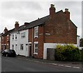
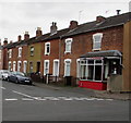
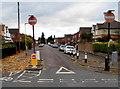
Photos of GL1 1JR


Area Information
GL1 1JR is a small, tightly knit residential postcode in England, home to around 1,517 people. This area is defined by its compact nature, with housing primarily focused on flats, catering to a young and dynamic population. The median age of 22 suggests a community dominated by young adults, many of whom may be students, professionals, or early-career individuals. Daily life here is shaped by proximity to Gloucester’s infrastructure, including its railway station and nearby airports, which offer swift connections to larger cities. The area’s small size means amenities are concentrated, with shops, services, and transport options within practical reach. While the population is relatively modest, the presence of multiple retail outlets like Morrisons and Aldi indicates a functional local economy. For those seeking a quiet yet connected base, GL1 1JR balances residential simplicity with access to broader opportunities, though its limited size means the character of the community is closely tied to its immediate surroundings.
- Area Type
- Postcode
- Area Size
- Not available
- Population
- Not available
- Population Density
- Not available
The property market in GL1 1JR is characterised by a low rate of home ownership, with only 26% of residents owning their homes. This suggests a rental-dominated market, likely driven by the area’s appeal to young professionals and students who may prioritise flexibility over long-term investment. The accommodation type is predominantly flats, which aligns with the needs of a younger demographic seeking compact, manageable living spaces. Given the small size of the postcode, the housing stock is limited, and buyers should consider the area’s proximity to larger towns like Gloucester for broader options. The prevalence of flats may also influence property values, with potential for growth tied to local demand or nearby developments. For those seeking a foothold in the area, the market’s rental focus and flat-centric nature mean competition could be keen, particularly for properties near transport links or amenities.
House Prices in GL1 1JR
No properties found in this postcode.
Energy Efficiency in GL1 1JR
Living in GL1 1JR offers a mix of convenience and practicality, with essential amenities within reach. The area includes five notable retail outlets, such as Morrisons Daily Gloucester and Aldi Linden, ensuring everyday shopping needs are met. Gloucester Railway Station provides direct access to regional transport networks, while three airports nearby—Gloucestershire Airport—cater to those requiring frequent travel. Though the area’s small size means leisure options are limited to local shops and services, the proximity to Gloucester suggests opportunities for dining, culture, and recreation beyond the immediate postcode. The presence of multiple retail points adds to the area’s appeal, offering a balance between self-sufficiency and the need to venture further for more specialised amenities. For residents prioritising ease of access, GL1 1JR’s layout supports a lifestyle that blends local convenience with regional connectivity.
Amenities
Schools
| Rank | School | Type | Entry gender | Ages |
|---|
Explore more schools in this area
Go to Schools tabDemographics
The population of GL1 1JR is overwhelmingly young, with the median age at 22 and the most common age range being 15–29 years. This demographic profile suggests a community of students, graduates, or young professionals, many of whom may be renting rather than owning homes. Only 26% of residents own their properties, with flats being the predominant accommodation type. The area’s ethnic composition is largely White, reflecting a homogenous demographic. While this data does not indicate levels of deprivation, the low home ownership rate and youth-centric population may point to a transient or economically mobile community. The absence of detailed diversity statistics means the area’s social fabric is less defined by multiculturalism, though this does not necessarily imply a lack of community cohesion. For buyers, understanding the age profile and housing dynamics is key to assessing long-term stability and suitability for different lifestyles.
Household Size
Accommodation Type
Tenure
Ethnic Group
Religion
Household Composition
Age
Household Deprivation
NS-SEC
Explore more demographic insights in this area
Go to Demographics tabPlanning
Planning Constraints
- Flood RiskPremium
- Ramsar Wetland SitesPremium
- Area of Outstanding Natural BeautyPremium
- Protected Nature ReservePremium
- Protected WoodlandPremium