Area Overview for Frome Vale Ward
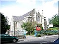
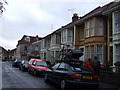
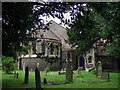
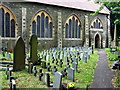
Photos of Frome Vale Ward
Area Information
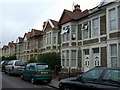
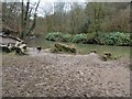
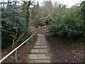
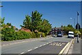
Frome Vale Ward is an electoral district situated in the northeast corner of Bristol, covering a compact 3.5 square kilometres. The population stands at 1,634 residents, creating a moderately dense community with approximately 467 people living per square kilometre. This area sits within the South West region and is represented by two members on Bristol City Council. Its defining characteristic is its close proximity to the River Frome, a waterway that runs through or near the ward's boundaries. The postcode BS16 0AN anchors this specific section of the city. Local history notes that the Bristol and Bath Cycle Path provides a key route through the location, linking it to broader transport networks. While the ward contains specific planning constraints related to protected woodland, it generally avoids major restrictions such as Areas of Outstanding Natural Beauty or Ramsar wetland sites. Living in Frome Vale Ward means residing in a defined urban zone that balances river-side heritage with city infrastructure. The area functions as a genuine residential part of Bristol rather than a distinct isolated village.
- Area Type
- District Borough Unitary Ward
- Area Size
- 3.5 km²
- Population
- 1634
- Population Density
- 467 people/km²
Demographics
The community within Frome Vale Ward displays a distinct demographic profile driven by age and ownership patterns. The median age for residents is 70 years, a figure that heavily influences the character of daily life and local service demand. Although the most common age category is listed simply as "Total", the high median age suggests a population with a significant concentration of older adults. Contrasting with this age profile is the fact that 58 per cent of households own their homes outright or with a mortgage. This indicates a level of stability often found in mature neighbourhoods. Data on household composition, predominant ethnicity, and religious affiliation remains unavailable in the provided records, so any specific claims on these topics would be speculative. What is known is that the ward hosts 1,634 individuals across various household sizes within its 3.5 square kilometre boundary. The absence of specific deprivation data means quality of life metrics regarding economic hardship remain unquantified in this dataset. However, the high rate of home ownership points towards a settled resident base rather than a transient population.
Household Size
Accommodation Type
Tenure
Ethnic Group
Religion
Household Composition
Age
Household Deprivation
NS-SEC
Explore more demographic insights in this area
Go to Demographics tabPlanning
Planning Constraints
- Flood RiskPremium
- Ramsar Wetland SitesPremium
- Area of Outstanding Natural BeautyPremium
- Protected Nature ReservePremium
- Protected WoodlandPremium