Area Overview for Four Acres Ward
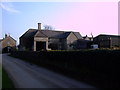
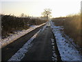
Photos of Four Acres Ward
Area Information
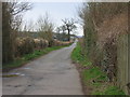
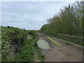
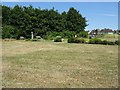
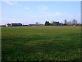
Four Acres Ward occupies a specific place within South West England, serving as an electoral ward of the Cotswold District Council. Located in Gloucestershire, this district borough unitary ward forms part of the Cirencester parish and the South Cotswolds parliamentary constituency. The area covers 1.9 km² and sits near Cirencester at coordinates approximately 51.7047°N, -1.9841°W. Recent data from 2023 indicates a resident population of approximately 1,821 people, though there were 1,471 registered electors in the same year. For those considering moving to this location, the compact size of the ward creates a concentrated living environment close to the historic market town. You will find yourself in a community that functions as a precinct within a larger administrative framework rather than a standalone municipality. The proximity to Cirencester defines the daily rhythm of life here, offering a blend of rural character and established town infrastructure. When you look for homes in Four Acres Ward, you are entering a zone defined by its administrative boundaries within the Cotswold District. This context matters for understanding local governance and planning decisions that affect you. The area sits firmly in the historic county of Gloucestershire, providing a setting where modern living intersects with a long-standing rural heritage. Your everyday life in Four Acres Ward is shaped by this specific geographical and administrative position.
- Area Type
- District Borough Unitary Ward
- Area Size
- 1.9 km²
- Population
- Not available
- Population Density
- Not available
Demographics
The community in Four Acres Ward reflects a mature settlement, with a median age of 70. This demographic profile suggests a neighbourhood where many residents are approaching or are in retirement. When you compare this to the national average, you will notice the area leans heavily towards an older population structure. The ward contains a total number of households, though specific breakdowns regarding single-person homes or families with children are not detailed in the primary datasets. You should expect a quieter residential atmosphere driven by this age distribution. Home ownership stands at 66% of households, indicating a majority of residents have purchased their properties. This high level of owner occupation often correlates with stability and long-term community investment. The remaining portion of the housing stock consists of rented accommodation. Regarding cultural composition, the ward has a predominant ethnic group, specific percentages of which are not broken out in the summary data. Religious affiliation follows a similar pattern where the total population is surveyed but specific denominational counts are not highlighted. You are moving into an area where the average resident is significantly older than the typical English household. Living in Four Acres Ward means navigating a community built around the needs and lifestyles of an older demographic.
Household Size
Accommodation Type
Tenure
Ethnic Group
Religion
Household Composition
Age
Household Deprivation
NS-SEC
Explore more demographic insights in this area
Go to Demographics tabPlanning
Planning Constraints
- Flood RiskPremium
- Ramsar Wetland SitesPremium
- Area of Outstanding Natural BeautyPremium
- Protected Nature ReservePremium
- Protected WoodlandPremium
- Crime RiskPremium