Area Overview for Exeter
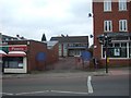
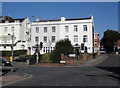
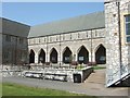
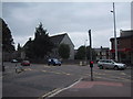
Photos of Exeter


Area Information
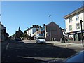
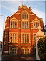
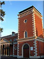
Exeter stands as a significant built-up area within Devon, serving as the county town and administrative centre for the region. This historic site sits within south east Devon at coordinates approximately 50.72°N, 3.51°W, acting as the focal point for local governance and commerce. The city covers an area of 29.6 km², hosting a population of 48,940 residents. Although official statistics cover a broader district of 47.877 km², the core urban environment concentrates this community. You will find yourself in an environment where the city council has held power since medieval times, currently operating from offices at the Civic Centre on Paris Street. Daily life revolves around a commercially vibrant centre centred on the historic cathedral, surrounded by cafes and restaurants. The area functions as a major economic driver for the wider region, including East Devon, Teignbridge, and Mid Devon. Major employers such as the university, NHS Foundation Trust, and the Met Office anchor the local economy. With its roots established in 1836 as a municipal borough and elevated to independent county borough status in 1889, Exeter continues to evolve while maintaining its identity. Recent governance changes include a new bid for unitary authority status submitted in late 2024 or early 2025. Living here means engaging with a city that balances deep historical roots with modern administrative functions and economic influence.
- Area Type
- District/Borough
- Area Size
- 29.6 km²
- Population
- 48940
- Population Density
- 1656 people/km²
Demographics
The community profile of Exeter reveals a settled population with an average age of 70 years. This high median age indicates a demographic weighted significantly towards older residents compared to many other English towns. Household composition data confirms that 60% of residents in Exeter own their homes outright or have a significant stake in their property. This suggests a stable, long-term population rather than a transient rental market. In terms of accommodation, the 60% ownership figure stands in contrast to areas dominated by private landlords, implying strong community ties among current residents. While specific statistics on ethnic diversity and religious affiliation are not detailed in the current profile, the overall demographic picture points to a mature society. The age total listed as "Age: Total" without a narrower breakdown reinforces the dominance of the older population bracket. You can expect neighbourhoods populated largely by those in retirement or semi-retirement phases of life. This demographic reality influences local services and community activities, shaping the social fabric of the city. Privacy and security are likely high priorities for this age group, influencing how they interact with public spaces and their immediate surroundings. The home ownership rate of 60% further underscores a desire for stability and investment in the local property market.
Household Size
Accommodation Type
Tenure
Ethnic Group
Religion
Household Composition
Age
Household Deprivation
NS-SEC
Explore more demographic insights in this area
Go to Demographics tabPlanning
Planning Constraints
- Crime RiskPremium