Area Overview for EX9 7EX
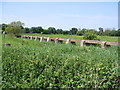
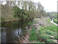
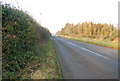
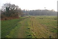
Photos of EX9 7EX


Area Information
Living in EX9 7EX means inhabiting a compact, residential postcode in England with a population of 1544 people spread across 157 individuals per square kilometre. This small cluster is defined by its quiet, low-density character, with most homes being owner-occupied and predominantly houses. The area’s appeal lies in its accessibility to nearby amenities, including three railway stations and a ferry landing, which connect residents to Exmouth and beyond. Daily life here is shaped by a mature demographic, with a median age of 47 and a significant proportion of residents aged 65 and over. The community is tightly knit, with local shops like Tesco Budleigh and Spar offering convenience. Safety is a key feature, with a crime risk score of 94, reflecting below-average crime rates. While the area lacks natural constraints like protected woodlands or AONBs, its proximity to rail and water transport adds practicality. For those seeking a peaceful, stable environment with easy access to services, EX9 7EX offers a straightforward, uncluttered lifestyle.
- Area Type
- Postcode
- Area Size
- Not available
- Population
- 1544
- Population Density
- 157 people/km²
The property market in EX9 7EX is dominated by owner-occupied homes, with 84% of residents living in houses rather than flats or rental properties. This suggests a stable, low-turnover market, where properties are likely held for the long term. The prevalence of houses over other accommodation types indicates a focus on family homes or larger residences, though the small population size means the housing stock is limited. Buyers in this area should expect a modest selection of properties, with little evidence of a rental market. The lack of planning constraints, such as protected woodlands or AONBs, may make the area attractive for those seeking straightforward development or renovation opportunities. However, the small size of the postcode means the immediate surroundings are critical for finding additional properties. For buyers prioritising security and low crime risk, the area’s safety score of 94 adds value.
House Prices in EX9 7EX
No properties found in this postcode.
Energy Efficiency in EX9 7EX
The lifestyle in EX9 7EX is shaped by its proximity to essential amenities, including five retail outlets such as Tesco Budleigh, Spar, and Co-op Budleigh. These shops provide everyday convenience, reducing the need for long trips to larger centres. The three railway stations and Exmouth Ferry Landing enhance mobility, allowing residents to access nearby towns or enjoy coastal travel. While the area lacks large parks or leisure facilities, the absence of planning constraints like protected woodlands or AONBs may leave room for local recreational spaces. The community’s character is defined by its quiet, low-density nature, with a focus on stability and accessibility. The mix of retail, transport, and modest connectivity ensures daily life remains practical, though larger-scale amenities may require venturing beyond the immediate postcode.
Amenities
Schools
The nearest school to EX9 7EX is Drake’s Church of England Primary School, which serves the local community with primary education. No secondary schools are listed in the data, so families requiring secondary education may need to look beyond the immediate area. The presence of a single primary school suggests that the area’s population is largely composed of older residents or those with children in higher education. For families with young children, Drake’s Primary offers a local option, though the absence of other schools may limit choices for older students. The school’s type—Church of England—implies a faith-based education framework, though specific Ofsted ratings are not provided. Parents should consider the need for additional schooling options when evaluating the area’s suitability for their family’s needs.
| Rank | School | Type | Entry gender | Ages |
|---|
Explore more schools in this area
Go to Schools tabDemographics
The community in EX9 7EX is predominantly elderly, with 65+ years being the most common age range and a median age of 47. Home ownership is high, at 84%, and the accommodation type is largely houses, reflecting a settled, long-term demographic. The predominant ethnic group is White, though specific diversity statistics are not provided. The low population density of 157 people per square kilometre suggests a spread-out, low-traffic residential environment. The area’s age profile indicates a population likely focused on retirement or long-term residency, with fewer young families. This shapes the local character, prioritising stability over rapid change. While no data on deprivation is available, the high home ownership and low crime risk imply a relatively secure quality of life. The absence of younger age groups may mean fewer schools or childcare facilities, which aligns with the single primary school listed nearby.
Household Size
Accommodation Type
Tenure
Ethnic Group
Religion
Household Composition
Age
Household Deprivation
NS-SEC
Explore more demographic insights in this area
Go to Demographics tabPlanning
Planning Constraints
- Flood RiskPremium
- Ramsar Wetland SitesPremium
- Area of Outstanding Natural BeautyPremium
- Protected Nature ReservePremium
- Protected WoodlandPremium